Hiking The Theodore Solomons Trail North: Roads End to Yosemite
- Updated: September 19, 2019
- Post By: Matthew Hengst

182 miles, 40,200' gain
Day 1: Roads End to Dougherty 13.1 miles, 6,600'
Day 2: The Bitch, Simpson Meadow, 17.4 miles, 1,500'
Day 3: Tehipite Valley 12.8 miles, 4,700'
Day 4: Rancheria 19.6 miles, 3,800'
Day 5: Courtright 21 miles, 2,600'
Day 6: 23 miles, 2,800'
Day 7: VVR 9.1 miles, 1,300'
Day 8: Cassidy 17 miles, 2,200'
Day 9: Clover 14 miles, 4,600'
Day 10: Fernandez & Merced Passes 19 miles, 3,500'
Day 11: Glacier Point & Yosemite Valley 13 miles, 1700'
[Pics] [Caltopo]
This is the second of two posts about my experiences hiking the relatively unknown long distance Sierra trail called the Theodore Solomons Trail. For the story of how the southern section went see Hiking The Theodore Solomons Trail South: Horseshoe Meadow To Roads End. For general details about the trail, resupply options, ect see Matt's Guide to The Theodore Solomons Trail.
My initial aggressive plan to try and do the whole trail in 12 days just hadn't been viable. I'd based my plans off a gps route that turned out to be rather seriously underestimating the mileage so after arriving at Roads End for a resupply I'd come off the trail, correct the map issues, and than made plans to head back out for an additional 11 days.
Of course since this was my grand summer of non employment I had to wait around a few days in civilization to lead another previously scheduled backpack in the Western Sierra after which I found myself driving back to Roads End ready to finish this thing!
Past the Crown Valley Cow Camp (which seemed to be shut down for the season already) the trail climbed steadily towards Crown Pass. The gain was nothing compared with the last few days but I had a difficult time sticking to what passed for a trail.

After about 3.8k gain I reached Crown Lake and slowly crossed the pass. Grateful to be going downhill on decent trail I skipped past Halfmoon Lake and pushed down to the North Fork of the Kings.

There were cabins and more campsites here but I still pushed on.

Right around dark I found a perfect spot with easy access to the river and a nice fire pit waiting for me.

I was rather happy to be back on well maintained trail and have a break from the large amounts of gain. Per my estimates if I could manage 24 miles and 4k gain by the end of the day I'd get to Weldon and then I'd only have 20 miles to VVR and my resupply. Unfortunately that was once again a bit agressive.

Interestingly enough the Meadowbrook Gauging Station had a cart similar to what we'd used on the Durwood Massacre trip though this one was padlocked and had a tag saying it wasn't to be used which was no fun at all.
The trail descended down towards Courtright reservoir and I started to run into backpackers just setting out for the weekend. That included one couple who was out on their very first backpack and were amazed by my description of what I was doing. I actually stopped for a while and gave them some pointers to help with the massive loads they were carrying.

There was a large trail crew set up at Chamberlains Camp working on the trail. They had a rather cooshy setup complete with solar showers and the site had a rather impressive outhouse which I'm always happy to take advantage of during long trips like this.
The trail brought me down to Courtright Reservoir where I it follows the Dusy Ershim 4WD Road around the northern end of the lake. Jen and I had done part of this on one of the Memorial Day Massacre trips so I wasn't too surprised at what I found.

It's a road but one that's intended for jeeps with winches meaning you have to traverse the occasional steep slab and large boulders.

It was also exposed, hot, and dry and tends to curve back on itself quite a bit making it feel slower than it should.

At the north end of the lake I jumped off on a trail and started up Helms Creek. Here the trail became a bit confused due to the fact there are multiple use trails and roads crisscrossing the area.
I was trying to push on as fast as I could but after I accidently ended up at Qualls Camp and had to cross country back to the correct trail I had to accept that continuing after dark just wasn't practical.
Right before losing the last of the light I found an old established camp near the trail junction north of Black Peak and stopped for the night several miles short of Weldon.

The fact I'd come up several miles short of Weldons Camp meant my food situation was looking a little sparse.
It had been a chilly night and I relit the fire briefly during breakfast to chase away the cold while I looked at my maps and communicated via inReach with my girlfriend Jen. I had 25 -ish miles from where I'd camped to my resupply at Vermilion Valley Resort which was doable *if* the trail was good. But if the TST had taught me anything so far it was that I couldn't rely on that.
Jen actually offered offered to drive out from Orange County and bring me more food when I crossed the road at Potter Pass which was a touching offer but seeing as how I was annoyed at myself for misjudging my mileage again I told her I'd manage.

I had some hope I might be able to scrounge some food around Potters Pass. I ran across a few people day hiking but all they could give me was a mangled cliff bar and two odd metal cans of rose flavored milk. Beggars and choosers though.

I was able to get cell reception during the climb to the pass though it went away right at the very top.
On the far side the trail makes a bit of an odd swerve visiting Upper & Lower Twin Lakes before continuing to drop towards Rattlesnake Crossing. I could have taken the trail to shortcut this section but as I've said before if I'm doing a trail like this I want to do the entire trail so I dutifully followed the loop.
The lakes were quite beautiful and would have made for a great camp had I been dividing the days up differently though they were quite busy with dayhikers and backpackers.

After that the trail crossed another dirt parking low below Kaiser Meadow before descending in earnest to Portuguese Flat & Rattlesnake Crossing. And here the trail started getting sparse again.
Portuguese Flat was just an overgrown meadow with a lot of downed logs and I never saw the camp spot that the USGS map mentions. By now the trail had mostly disappeared and I was following the occasional duck.

I reached Rattlesnake Crossing at around 6 pm and figured once again I wasn't going to make my goal for the day before it became too dark to continue. I found a decent campsite on the southern side of the bridge and considered stopping but I wanted to get as close as possible to VVR tonight since I was all but out of food.

I kept expecting to find another site but sadly while the river was beautiful the sides were rugged and I didn't see anything I could have ethically used as a campsite. When the trail started to climb away from the river it once again became basically cross country with the occasional remains of what I assumed were old trail barriers. And appropriately I had a rattlesnake go off not far from me during this section.

By the time I reached what the map showed as the trail junction where I would turn east towards Vermillion Resort I was a bit concerned. It was almost dark, the trail was almost non existent, and I was really low on water. I could hear running water in places but it was so buried in vegetation there was no way I could get to it. So feeling like I had little choice I climbed a rocky hillside really hoping to find a clear trail out to VVR.

Yea, so about that. The western approach to VVR is basically cross country with the occasional duck or scrap of trail. On the plus side the terrain was a bit more open making it a bit easier if you can avoid getting stuck in the rocks or stands of vegetation.
I found plenty of places where I could have thrown out my bivy but I really needed water now. I kept pushing on to the next next intermittent stream hoping to find at least a small pool but they were all completely dry.
I finally found a small flat area next to a trickle of water about an hour after dark. I drank my fill, ate a scrap of a Kind bar that basically constituted the remainder of my food, and collapsed.


I awoke to a pissed of squirrel yelling at me from a nearby tree. Not having any sort of warm food I just shoved the last remains of a bar in my mouth and started moving driven on by the fantasies of hot food at VVR.

China Camp was marked on the USGS and was another thing that had given me hope that I would find a trail. But it was a ruin with one of the two cabins having been crushed by a large tree and a stream working its way through the foundation.

After what seemed a painfully long time the trail ran out past another set of cabins and dumped me on a dirt road leading down to the resort.

I was overjoyed to arrive and wasted no time getting into the cafe and ordering food.

While most of the staff was nice the cook seemed rather unhappy to be cooking. He took my order somewhat reluctantly and when the ferry arrived maybe 30 minutes later I overheard him arguing that he wanted to shut down breakfast orders without an announcement.
I ate a large breakfast burrito, drank about 12 cups of coffee, then a sizable lunch with a large beer, and because they were out of milkshake material I helped myself to an ice cream bar from their freezer. In between I grabbed a shower and even splurged and did laundry before kicking back out front since I didn't want to leave until my Anker battery pack was sufficiently recharged.

And of course I had my gloriously packed resupply box filled with precious precious calories.

They don't have cell reception at the resort and while there is a wifi network they apparently don't even give the credentials out to the employees. You can walk about a half mile up the road and pick up an AT&T ower if you are so inclined.

And while I was sitting out there visiting with two PCT hikers we had the added entertainment of seeing three game wardens descend on someone in the campground and march them off in handcuffs.
Finally when the ferry took my PCT friends away at 4 pm I called it good and reshouldered my pack.

I was in far better spirits now and I took the opportunity while I had cell service along the ridge to check in with some folks.
I ended up camping in a slightly better spot near where I'd camped the night before since I knew that was the last water I was going to see and I suspected that the next day was going to be rough.

And yes, the next section was damned hard. Once again there were signs I was on a trail here and there but it I was effectively just hiking cross country and the terrain wasn't the friendliest.

It was a damned pretty area and I enjoyed the views though I couldn't help notice that the clouds off in the distant were looking a bit like rain.

Also interesting enough I could see a rock structure off in the distance that looked a lot like Devil's Postpile.
This section from Rattlesnake Crossing to Cassidy Bridge is the absolute worst section of the Theodore Solomons. Even with a GPS I found myself having to work to keep to any semblance of what might have once been a trail. I was constantly having to climb over downed trees and for a long section the ground was covered with so many dead branches that I had to stomp my way through them snapping and rolling with each step. Other sections had me sidehilling along slopes slick with pine needles.
I plowed onward holding onto the hope that when I reached what the map showed as the Heitz Meadow Forest Service Station maybe just maybe there would be better trail.

But that wasn't to be. The station was long abandoned.


An attempt had been made to secure the cabins at some point but one of the doors around the back was open letting me poke around inside. They didn't show signs of being visited very often.


The clouds were building and I hurried on. A few miles later fearing it might start raining on me at any minute I briefly looked at staying at Rattlesnake Lake but didn't find any decent campsites near the trail.

Past Rattlesnake Lake the trail was badly overgrown and as I went down the switchbacks I had to leave the trail and crawl at times to keep moving forward. And as an added bonus since I was back at a lower altitude again the gnats had returned with a vengeance meaning I had to try and protect my precious headnet while bushwhacking. And to top it all off it started to rain.
I rushed down to the river just grateful that the rain didn't seem to be getting any harder.
Oddly enough when I reached the bottom the trail started to go north along the river instead of south to where the map showed a bridge. I had to recheck my map and then backtrack to follow a much fainter fork.

It was an impressive bit of construction.

The area around the bridge showed signs of heavy usage presumably people accessing it from the river based on the grills and abandoned inflatable rafts I found discarded around the campsites.

The best campsite I found was to the left when you exit the bridge. If doesn't suit your fancy there were a few more serviceable ones off to the right.
The biggest challenge here was just finding enough downed wood to have a campfire since the area had been picked over but I managed by climbing up the hill.

Yesterday had been brutal. The terrain had had me fighting for every step despite the fact I'd mostly been descending. And I today I knew I had a long climb ahead of me.

Fortunately the trail was gloriously clear and easy to follow which combined with the fact I had more than enough food had me practically skipping my way up out of the canyon.


I've also decided I really need to do Balloon Dome. It's a damned impressive sight that just dominates the area.

My nice well traveled trail led me to a nice solid bridge across Granite Creek before joining dirt roads which I followed down to Clover Meadow.

Clover Meadow has a drive in campground which I've stayed at before and a small ranger station. I was a bit starved for conversation by now and I admit I was hoping to find the ranger in a chatty mood. Sadly it was closed on Tuesdays and Wednesdays so I had to settle for drinking my fill out of their water spigot and a few brief exchanges with people as I passed through the campground. Also it was apparently now squirrel season so I had to worry about hunters in the area.

The trail after Clover continues to climb up towards Fernandez Pass.

I found I had cell reception again and lost a bit of my momentum enjoying the views and checking in with some folks back home. At this point I was looking to be in good shape to finish the day after tomorrow so when I found a nice camp an hour and a half before sunset I decided to avail myself of yet another campfire.

The site I stayed at was located right at the trail junction which was a bit more public than I usually like but I didn't see a single person the entire time I was there. The next morning while looking for a place to dig a cathole I found a much nicer series of sites off to the northeast so if you're staying here I'd strongly recommend going over there.

I had two passes and a bit of high country to get over before I'd be down by the Illilouette River and basically home free.
I loved the views as I climbed up toward the pass but despite the lack of people the area did feel a lot less remote than where I'd been the previous few days. I could periodically hear large trucks off in the distance and became used to the constant drone of airplanes overhead.

It was a solid climb up over Fernandez Pass but the fact I could see clouds building all around me kept me pushing forward despite complaining feet.

The area between the passes was really nice and if I ever do this again I'll plan to camp up here. Especially since once you are over Merced you're down in a burn area.


Merced Pass was gentle and forested making for a pleasant final pass.

Once I was across I was greeted by Mount Starr King off in the distance which happened to be the peak I was planning to lead right after I finished the TST.
From here it was all downhill except for an easy 2 mile climb to get to Glacier Point. I pushed on determined to find one last campsite with a fire pit which I managed right before dark. I had only 8 more miles between me and the end of the trail...

...but as it turned out I I would end up doing a little extra to wrap things up.
The north terminus of the Theodore Solomons Trail is Glacier Point. It's a spectacular overlook with views of Half Dome and Yosemite Valley itself and tends to be one of those places where even a picture with the worst camera possible ends up looking amazing.

As I climbed the last two miles to Glacier Point I could see the start of the John Muir Trail down below where Jen and I had started late one Sunday evening way back in the beginning of August.

I was back in Yosemite after over 500 miles of some of the prettiest terrain the Sierra has to offer across the east and west sides. And I'd done the entirety of a trail that few people seem to have even written about which made me excited to share with my site and hiking friends back home.
Not to mention I had a well deserved beer and burger waiting for me down in the valley.

Glacier Point was somewhat of an anticlimax. I arrived to find the place was a zoo thanks to a citizenship ceremony they were holding. People and horses were running everywhere and the nice seat I'd been dreaming about in their little amphitheater was taken by the spectators.
The plan had been to meet my friends Jack and Rod here and get ferried down to the valley where we'd eat and pick up our permit for the Mount Starr King trip we were starting the following day. (It was going to be a relatively low mileage trip with a bit of technical rope work and a fun group of participants so I figured it would be a decent way to recover after the TST.)
I was able to text Jack and he told me he was about an hour away thanks to construction work on the road. It seemed a bit silly to just sit around up there when there were showers and more importantly beer just 4 miles below. So I shouldered my pack (which by now was again pleasantly light), texted Jack that I'd just meet him down in the Valley, and headed for the Four Mile Trail.


It was an easy walk but the amount of steep downhill did endup leaving me a bit sore which I found amusing after everything I'd been doing over the past few weeks.
I reached the bottom and decided a shower was the first order of business. A helpful park employee recommended using the ones at Curry Village instead of Housekeeping Camp so I jumped on a shuttle and headed over.
Unfortunately the showers at Curry all have a combination lock and the office where you can pay for a shower didn't have anyone in it. But I did make a friend who was nice enough to just give me the combo allowing me to enjoy a much needed shower.
The shuttles this year have been having a major issue running late and being overcrowded so I decided to just walk from Curry Village down to Yosemite Lodge where I was able to finally get that beer I'd been craving for the last hundred miles or so. What's another mile or two after all?

Jack and Rod soon found me and I companionably joined them in another meal, another beer, and some coffee. Unfortunately due to a miscommunication they'd still gone to Glacier and then had to drive all the way back down to the valley. After grabbing our permit and eating our fill we headed off to Mono Meadows where we would be meeting the group we'd be leading up Mount Starr King over the next three days. No rest for the wicked!
If you've done the John Muir Trail or parts of the Pacific Crest Trail and found that to be difficult then this trail probably isn't what for you. It's longer, has more gain, and the terrain is just punishing for long sections. In addition the resupply logistic are a much bigger challenge than those trails.
Also the time when you can do this trail is limited thanks to the crossing over the Middle Fork of the Kings. Anything other than late summer you're going to risk not being able to get across unless you want to do what a few others have done and avoid that section completely.
But on the other hand if you're looking for a challenge and enjoy visiting some less traveled areas it's a great alternative. It passes through a lot of my favorite parts of the southern and western sierra and it'll give you an accomplishment that not a lot of people can claim.

To further illustrate just how few people have done the trail when I made a post on the Theodore Solomons Trail facebook group I was contacted by Gary Buscombe who wrote a the 1983 guide to the trail and he send me this awesome patch celebrating my accomplishment. What a guy!
Will I ever do it again? Probably not the entire route. Am I glad I did it? Absolutely!
This is the second of two posts about my experiences hiking the relatively unknown long distance Sierra trail called the Theodore Solomons Trail. For the story of how the southern section went see Hiking The Theodore Solomons Trail South: Horseshoe Meadow To Roads End. For general details about the trail, resupply options, ect see Matt's Guide to The Theodore Solomons Trail.
My initial aggressive plan to try and do the whole trail in 12 days just hadn't been viable. I'd based my plans off a gps route that turned out to be rather seriously underestimating the mileage so after arriving at Roads End for a resupply I'd come off the trail, correct the map issues, and than made plans to head back out for an additional 11 days.
Of course since this was my grand summer of non employment I had to wait around a few days in civilization to lead another previously scheduled backpack in the Western Sierra after which I found myself driving back to Roads End ready to finish this thing!
Based off my improved route estimates I decided I could get away with a single resupply at Vermillion Resort. Normally you can mail a package to an address of theirs down the hill and they transport it to the resort and then hold it for you but that required a bigger lead time than I had.

Fortunately since we were already in the general vicinity of Lake Thomas Edison for that other backpack my girlfriend and I were able to drive an extra hour and drop off my resupply box in person.
The staff was a bit bemused but friendly and it peaked their interest that I wasn't doing the usual PCT / JMT plan which is where most of their foot traffic comes from.

After hiking out of my previous trip Sunday afternoon I'd driven out to Roads End and slept at the trailhead. My plan was to leave the jeep at the Copper Creek Trailhead and then hike to Yosemite over the next 11 days or so where I'd meet another friend and lead another backpack before getting a ride back to my car.

There's no special permit for the Theodore Solomons Trail so I just had to get a normal overnight for the Copper Creek Trailhead. Fortunately permits are easy to get since there is a permit station at the end of the road and since I was leaving on a Monday I was pretty sure I could get a walk in.
I was there when it opened and sure enough I snagged one of several walk in permits. The ranger was quite interested in my plans since she mostly just issues permits for Rae Lakes or Big SEKI loops these days and she'd never even heard of anyone going through Tehipite Valley.
After returning to the jeep and eating breakfast it was time to get moving. And it was a good thing I was feeling fresh because today I had a good steady climb from 5,000' to 10,600' to cross Granite Pass. And since I had 6 days of food plus water my pack rang in at 40 lbs on the scale by the ranger station. Ouch.

The trail leading up Copper Creek is well established and you have access to water along the way. My pack felt heavy but reasonable as I set out in high spirits.
And at the second switchback I was promptly swarmed by gnats. They didn't bite but there were so many I couldn't keep them out of my face and had to resort to wearing my bug net for most of the day. And sweating profusely inside a bug net is really obnoxious as it gets everywhere.

By the time I reached Granite Basin I was dragging a bit and started looking for campsites. Unless I was willing to do without water the only options required leaving the trail and dropping down to one of the lakes I could see several hundred feet below and I felt like I'd been working too hard to get up this high to do that.

So I limped my way up and over Granite Pass which is quite scenic and gentle if you haven't say just done 6.5k of gain with 40 pound pack.

On the far side there are a series of meadows with some decent campsites scattered around. I came across several other groups and everyone I talked to do was doing the Big SEKI Loop and said they'd taken two days to get up and over the pass. I had to go past the first few meadows until I found a workable spot across the stream at about 10k.

I found a suitable patch of ground, threw out my bivy, and settled in for the night with some relief.

Day 1 had been work but Day 2 would see me entering the section I was most intrigued over which was Tehipite Valley. To get there I'd be losing most of gain I'd made the previous day and I'd have to make my way across the Middle Fork of the Kings River. This is a notoriously difficult crossing early in the season and generally the greatest source of concern for people doing the trail.
It had been cold enough overnight that my water had frozen. That made the morning a little less pleasant but it was a good sign considering the valley is at 4,100' and I'd been concerned about it being too warm down there.

After a gentle start I reached the descent down to Simpson Meadow. Per the Roaring River ranger this and the climb out of the valley are referred to as The Bitch and Son of the Bitch depending which way you are headed. It was certainly a knee pounder but at least the trail was in good shape since the Big SEKI Loop comes down this way before splitting off to the north east.

I reached Simpson Meadow and feeling cocky I ignored the beta I'd been given to head off to the north to cross and just bushwhacked over to the Kings. I figured this late in the season I could make something work and just ford across. This was a bad idea. The brush was thick and I didn't see anything I particularly wanted to try fording with a full pack.
I eventually gave up, fought my way back to the trail, and went back to where I'd been told to try and cross. There I found a workable boots off crossing about a half mile north of where I'd dropped into the valley.

Before I could even get to the main part of the crossing I had to take my boots off and bushwhack through flooded trees.

The crossing itself was wide and I never saw any logs that spanned it. By this late in the season most of it was shallow but there was a deeper channel on the far side that got up to mid thigh with a strong current.

Having made it across I triumphantly set off down the trail eager to try and make it to Tehipite Valley itself before I ran out of daylight...

...which did not happen. There is a trail through here or at least there used to be. I could see that a not insignificant amount of work had been put in to sawing through large logs and building stone steps along the side of the canyon but it's also apparent it must have been done years ago. It was slow sweaty going and I lost count of the amount of logs I had to climb over. Also since I was back down below 6k the gnats were back in force meaning I was once again inside a sweaty bug net.

I eventually had to come to accept I wasn't going to make the valley tonight unless I wanted to be bushwhacking after dark. Which I most assuredly not want to do.

I couldn't find anything that would work as a campsite along the trail but a short time before sunset I found a large sandy bank that worked quite nicely. I spent an exceedingly pleasant evening drying off my salt and sweat caked layers by a fire.

The next morning I took advantage of the river access to do my laundry and hang the wet clothes off the back of my pack. I had built up thick rings of salt from all the sweating over the last two days.

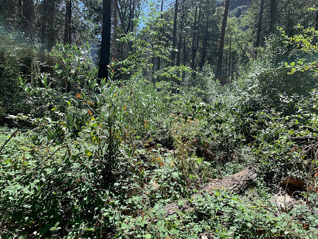
The trail continued to vary from clear and well established to sections where downed trees and overgrown vegetation had all but obliterated it. I kept hoping it might get a bit easier but every time it did the improvement didn't last long.

There ended up being a lot more camping options the closer I got to Tehipite Valley.

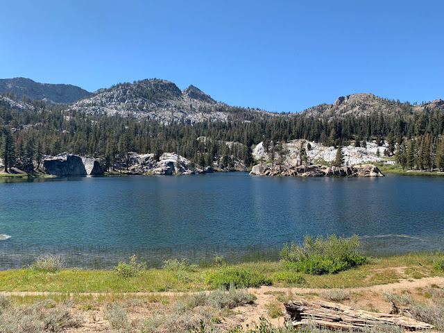
Tehipite Valley had been on my radar for years thanks to the descriptions I'd read of the remote and rugged valley and my short visit through didn't disappoint.

The water in the Kings was also a brilliant blue that I struggled to capture in pictures and in every direction the massive granite walls were punctuated by waterfalls.
It was warm but bearable and since it's down around 4k you actually find yuccas growing. I had heard second hand reports of it being so warm that people had to watch for rattlesnakes hanging out in the trees and bushes but I never came across a single snake. What I did find a lot of was bear scat which seemed to be everywhere though I never saw or heard an actual bear.

It was interesting getting to see Tehipite Dome from the bottom. I'd been on the side of that thing looking down to the valley floor 3,500' below when I failed to get it in 2016.
Since I was down here I decided I could spare a short while to go looking for Painted Rock which is marked on the USGS. I figured it might be a while until I was back out this way.

After a bit of exploring and coming across a few different sets of footprints I found a small number of drawings on the side of a boulder.
The scattered footprints had me hopeful that the climb up the far side would be in good shape but the western end of the valley proved to be more of the same.

But fortunately the trail climbing out of Tehipite Valley (aka The Bitch or The Son of a Bitch) was damned steep but but in passable shape except for the occasional downed tree.

The bugs disappeared part way through the climb which was a relief. I'd been getting tired of dabbing sweat off the mesh of my bugnet so I could see.
When I reached the top of the climb I entered an area that had been burned in the big 2008 Tehipite Fire. There was a really nice campsite right at the top of the trail that had a view of the valley below but I didn't have enough water to manage a dry camp.

I had enough energy and daylight I could have pushed out a few more miles but I just couldn't pass up the spectacular campsite I found in Hay Meadow. I even saw a baby bear across the way when I arrived. So I scouted out some firewood and had another really nice evening listening to the water flowing nearby.

I was back on familiar trail now since I'd been through this area to climb Spanish Mountain and attempt Tehipite Dome. Which meant I wasn't surprised when the trail entered a burn area and disappeared under hated white thorn bushes.

I'd strongly recommend not wearing shorts as they will scrape you bloody.
I ran into a large group here that was starting out on an 8 day trip down into Tehipite Valley. I chatted with them a bit about what I'd seen and where I was headed.

Fortunately since we were already in the general vicinity of Lake Thomas Edison for that other backpack my girlfriend and I were able to drive an extra hour and drop off my resupply box in person.
The staff was a bit bemused but friendly and it peaked their interest that I wasn't doing the usual PCT / JMT plan which is where most of their foot traffic comes from.
Day 1: Roads End, Granite Pass, Dougherty
After hiking out of my previous trip Sunday afternoon I'd driven out to Roads End and slept at the trailhead. My plan was to leave the jeep at the Copper Creek Trailhead and then hike to Yosemite over the next 11 days or so where I'd meet another friend and lead another backpack before getting a ride back to my car.

There's no special permit for the Theodore Solomons Trail so I just had to get a normal overnight for the Copper Creek Trailhead. Fortunately permits are easy to get since there is a permit station at the end of the road and since I was leaving on a Monday I was pretty sure I could get a walk in.
I was there when it opened and sure enough I snagged one of several walk in permits. The ranger was quite interested in my plans since she mostly just issues permits for Rae Lakes or Big SEKI loops these days and she'd never even heard of anyone going through Tehipite Valley.
After returning to the jeep and eating breakfast it was time to get moving. And it was a good thing I was feeling fresh because today I had a good steady climb from 5,000' to 10,600' to cross Granite Pass. And since I had 6 days of food plus water my pack rang in at 40 lbs on the scale by the ranger station. Ouch.

The trail leading up Copper Creek is well established and you have access to water along the way. My pack felt heavy but reasonable as I set out in high spirits.
And at the second switchback I was promptly swarmed by gnats. They didn't bite but there were so many I couldn't keep them out of my face and had to resort to wearing my bug net for most of the day. And sweating profusely inside a bug net is really obnoxious as it gets everywhere.

By the time I reached Granite Basin I was dragging a bit and started looking for campsites. Unless I was willing to do without water the only options required leaving the trail and dropping down to one of the lakes I could see several hundred feet below and I felt like I'd been working too hard to get up this high to do that.

So I limped my way up and over Granite Pass which is quite scenic and gentle if you haven't say just done 6.5k of gain with 40 pound pack.

On the far side there are a series of meadows with some decent campsites scattered around. I came across several other groups and everyone I talked to do was doing the Big SEKI Loop and said they'd taken two days to get up and over the pass. I had to go past the first few meadows until I found a workable spot across the stream at about 10k.

I found a suitable patch of ground, threw out my bivy, and settled in for the night with some relief.
Day 2: The Bitch, Simpson Meadow, Middle Fork of The Kings, Tehipite Valley
Day 1 had been work but Day 2 would see me entering the section I was most intrigued over which was Tehipite Valley. To get there I'd be losing most of gain I'd made the previous day and I'd have to make my way across the Middle Fork of the Kings River. This is a notoriously difficult crossing early in the season and generally the greatest source of concern for people doing the trail.
It had been cold enough overnight that my water had frozen. That made the morning a little less pleasant but it was a good sign considering the valley is at 4,100' and I'd been concerned about it being too warm down there.

After a gentle start I reached the descent down to Simpson Meadow. Per the Roaring River ranger this and the climb out of the valley are referred to as The Bitch and Son of the Bitch depending which way you are headed. It was certainly a knee pounder but at least the trail was in good shape since the Big SEKI Loop comes down this way before splitting off to the north east.

I reached Simpson Meadow and feeling cocky I ignored the beta I'd been given to head off to the north to cross and just bushwhacked over to the Kings. I figured this late in the season I could make something work and just ford across. This was a bad idea. The brush was thick and I didn't see anything I particularly wanted to try fording with a full pack.
I eventually gave up, fought my way back to the trail, and went back to where I'd been told to try and cross. There I found a workable boots off crossing about a half mile north of where I'd dropped into the valley.

Before I could even get to the main part of the crossing I had to take my boots off and bushwhack through flooded trees.

The crossing itself was wide and I never saw any logs that spanned it. By this late in the season most of it was shallow but there was a deeper channel on the far side that got up to mid thigh with a strong current.

Having made it across I triumphantly set off down the trail eager to try and make it to Tehipite Valley itself before I ran out of daylight...

...which did not happen. There is a trail through here or at least there used to be. I could see that a not insignificant amount of work had been put in to sawing through large logs and building stone steps along the side of the canyon but it's also apparent it must have been done years ago. It was slow sweaty going and I lost count of the amount of logs I had to climb over. Also since I was back down below 6k the gnats were back in force meaning I was once again inside a sweaty bug net.

I eventually had to come to accept I wasn't going to make the valley tonight unless I wanted to be bushwhacking after dark. Which I most assuredly not want to do.

I couldn't find anything that would work as a campsite along the trail but a short time before sunset I found a large sandy bank that worked quite nicely. I spent an exceedingly pleasant evening drying off my salt and sweat caked layers by a fire.
Day 3: Tehipite Valley, Hay Meadow

The next morning I took advantage of the river access to do my laundry and hang the wet clothes off the back of my pack. I had built up thick rings of salt from all the sweating over the last two days.

The trail continued to vary from clear and well established to sections where downed trees and overgrown vegetation had all but obliterated it. I kept hoping it might get a bit easier but every time it did the improvement didn't last long.

There ended up being a lot more camping options the closer I got to Tehipite Valley.

Tehipite Valley had been on my radar for years thanks to the descriptions I'd read of the remote and rugged valley and my short visit through didn't disappoint.

The water in the Kings was also a brilliant blue that I struggled to capture in pictures and in every direction the massive granite walls were punctuated by waterfalls.
It was warm but bearable and since it's down around 4k you actually find yuccas growing. I had heard second hand reports of it being so warm that people had to watch for rattlesnakes hanging out in the trees and bushes but I never came across a single snake. What I did find a lot of was bear scat which seemed to be everywhere though I never saw or heard an actual bear.

It was interesting getting to see Tehipite Dome from the bottom. I'd been on the side of that thing looking down to the valley floor 3,500' below when I failed to get it in 2016.
Since I was down here I decided I could spare a short while to go looking for Painted Rock which is marked on the USGS. I figured it might be a while until I was back out this way.

After a bit of exploring and coming across a few different sets of footprints I found a small number of drawings on the side of a boulder.

The scattered footprints had me hopeful that the climb up the far side would be in good shape but the western end of the valley proved to be more of the same.

But fortunately the trail climbing out of Tehipite Valley (aka The Bitch or The Son of a Bitch) was damned steep but but in passable shape except for the occasional downed tree.

The bugs disappeared part way through the climb which was a relief. I'd been getting tired of dabbing sweat off the mesh of my bugnet so I could see.
When I reached the top of the climb I entered an area that had been burned in the big 2008 Tehipite Fire. There was a really nice campsite right at the top of the trail that had a view of the valley below but I didn't have enough water to manage a dry camp.

I had enough energy and daylight I could have pushed out a few more miles but I just couldn't pass up the spectacular campsite I found in Hay Meadow. I even saw a baby bear across the way when I arrived. So I scouted out some firewood and had another really nice evening listening to the water flowing nearby.
Day 4: Rancheria, Crown Pass

I'd strongly recommend not wearing shorts as they will scrape you bloody.
I ran into a large group here that was starting out on an 8 day trip down into Tehipite Valley. I chatted with them a bit about what I'd seen and where I was headed.
Past the Crown Valley Cow Camp (which seemed to be shut down for the season already) the trail climbed steadily towards Crown Pass. The gain was nothing compared with the last few days but I had a difficult time sticking to what passed for a trail.

After about 3.8k gain I reached Crown Lake and slowly crossed the pass. Grateful to be going downhill on decent trail I skipped past Halfmoon Lake and pushed down to the North Fork of the Kings.

There were cabins and more campsites here but I still pushed on.

Right around dark I found a perfect spot with easy access to the river and a nice fire pit waiting for me.
Day 5: Meadow Brook, Courtwright

I was rather happy to be back on well maintained trail and have a break from the large amounts of gain. Per my estimates if I could manage 24 miles and 4k gain by the end of the day I'd get to Weldon and then I'd only have 20 miles to VVR and my resupply. Unfortunately that was once again a bit agressive.

Interestingly enough the Meadowbrook Gauging Station had a cart similar to what we'd used on the Durwood Massacre trip though this one was padlocked and had a tag saying it wasn't to be used which was no fun at all.
The trail descended down towards Courtright reservoir and I started to run into backpackers just setting out for the weekend. That included one couple who was out on their very first backpack and were amazed by my description of what I was doing. I actually stopped for a while and gave them some pointers to help with the massive loads they were carrying.

There was a large trail crew set up at Chamberlains Camp working on the trail. They had a rather cooshy setup complete with solar showers and the site had a rather impressive outhouse which I'm always happy to take advantage of during long trips like this.
The trail brought me down to Courtright Reservoir where I it follows the Dusy Ershim 4WD Road around the northern end of the lake. Jen and I had done part of this on one of the Memorial Day Massacre trips so I wasn't too surprised at what I found.

It's a road but one that's intended for jeeps with winches meaning you have to traverse the occasional steep slab and large boulders.

It was also exposed, hot, and dry and tends to curve back on itself quite a bit making it feel slower than it should.

At the north end of the lake I jumped off on a trail and started up Helms Creek. Here the trail became a bit confused due to the fact there are multiple use trails and roads crisscrossing the area.
I was trying to push on as fast as I could but after I accidently ended up at Qualls Camp and had to cross country back to the correct trail I had to accept that continuing after dark just wasn't practical.
Right before losing the last of the light I found an old established camp near the trail junction north of Black Peak and stopped for the night several miles short of Weldon.
Day 6: Potter Pass, Rattlesnake Crossing, And No Food

The fact I'd come up several miles short of Weldons Camp meant my food situation was looking a little sparse.
It had been a chilly night and I relit the fire briefly during breakfast to chase away the cold while I looked at my maps and communicated via inReach with my girlfriend Jen. I had 25 -ish miles from where I'd camped to my resupply at Vermilion Valley Resort which was doable *if* the trail was good. But if the TST had taught me anything so far it was that I couldn't rely on that.
Jen actually offered offered to drive out from Orange County and bring me more food when I crossed the road at Potter Pass which was a touching offer but seeing as how I was annoyed at myself for misjudging my mileage again I told her I'd manage.

I had some hope I might be able to scrounge some food around Potters Pass. I ran across a few people day hiking but all they could give me was a mangled cliff bar and two odd metal cans of rose flavored milk. Beggars and choosers though.

I was able to get cell reception during the climb to the pass though it went away right at the very top.
On the far side the trail makes a bit of an odd swerve visiting Upper & Lower Twin Lakes before continuing to drop towards Rattlesnake Crossing. I could have taken the trail to shortcut this section but as I've said before if I'm doing a trail like this I want to do the entire trail so I dutifully followed the loop.

The lakes were quite beautiful and would have made for a great camp had I been dividing the days up differently though they were quite busy with dayhikers and backpackers.

After that the trail crossed another dirt parking low below Kaiser Meadow before descending in earnest to Portuguese Flat & Rattlesnake Crossing. And here the trail started getting sparse again.
Portuguese Flat was just an overgrown meadow with a lot of downed logs and I never saw the camp spot that the USGS map mentions. By now the trail had mostly disappeared and I was following the occasional duck.

I reached Rattlesnake Crossing at around 6 pm and figured once again I wasn't going to make my goal for the day before it became too dark to continue. I found a decent campsite on the southern side of the bridge and considered stopping but I wanted to get as close as possible to VVR tonight since I was all but out of food.

I kept expecting to find another site but sadly while the river was beautiful the sides were rugged and I didn't see anything I could have ethically used as a campsite. When the trail started to climb away from the river it once again became basically cross country with the occasional remains of what I assumed were old trail barriers. And appropriately I had a rattlesnake go off not far from me during this section.

By the time I reached what the map showed as the trail junction where I would turn east towards Vermillion Resort I was a bit concerned. It was almost dark, the trail was almost non existent, and I was really low on water. I could hear running water in places but it was so buried in vegetation there was no way I could get to it. So feeling like I had little choice I climbed a rocky hillside really hoping to find a clear trail out to VVR.

Yea, so about that. The western approach to VVR is basically cross country with the occasional duck or scrap of trail. On the plus side the terrain was a bit more open making it a bit easier if you can avoid getting stuck in the rocks or stands of vegetation.
I found plenty of places where I could have thrown out my bivy but I really needed water now. I kept pushing on to the next next intermittent stream hoping to find at least a small pool but they were all completely dry.
I finally found a small flat area next to a trickle of water about an hour after dark. I drank my fill, ate a scrap of a Kind bar that basically constituted the remainder of my food, and collapsed.
Day 7 Vermillion Resort Resupply, Food At Last


I awoke to a pissed of squirrel yelling at me from a nearby tree. Not having any sort of warm food I just shoved the last remains of a bar in my mouth and started moving driven on by the fantasies of hot food at VVR.

China Camp was marked on the USGS and was another thing that had given me hope that I would find a trail. But it was a ruin with one of the two cabins having been crushed by a large tree and a stream working its way through the foundation.

After what seemed a painfully long time the trail ran out past another set of cabins and dumped me on a dirt road leading down to the resort.

I was overjoyed to arrive and wasted no time getting into the cafe and ordering food.

While most of the staff was nice the cook seemed rather unhappy to be cooking. He took my order somewhat reluctantly and when the ferry arrived maybe 30 minutes later I overheard him arguing that he wanted to shut down breakfast orders without an announcement.
I ate a large breakfast burrito, drank about 12 cups of coffee, then a sizable lunch with a large beer, and because they were out of milkshake material I helped myself to an ice cream bar from their freezer. In between I grabbed a shower and even splurged and did laundry before kicking back out front since I didn't want to leave until my Anker battery pack was sufficiently recharged.

And of course I had my gloriously packed resupply box filled with precious precious calories.

They don't have cell reception at the resort and while there is a wifi network they apparently don't even give the credentials out to the employees. You can walk about a half mile up the road and pick up an AT&T ower if you are so inclined.

And while I was sitting out there visiting with two PCT hikers we had the added entertainment of seeing three game wardens descend on someone in the campground and march them off in handcuffs.
Finally when the ferry took my PCT friends away at 4 pm I called it good and reshouldered my pack.

I was in far better spirits now and I took the opportunity while I had cell service along the ridge to check in with some folks.
I ended up camping in a slightly better spot near where I'd camped the night before since I knew that was the last water I was going to see and I suspected that the next day was going to be rough.
Day 8: Heitz Meadow, Rattlesnake Lake, Cassidy Bridge

And yes, the next section was damned hard. Once again there were signs I was on a trail here and there but it I was effectively just hiking cross country and the terrain wasn't the friendliest.

It was a damned pretty area and I enjoyed the views though I couldn't help notice that the clouds off in the distant were looking a bit like rain.

Also interesting enough I could see a rock structure off in the distance that looked a lot like Devil's Postpile.
This section from Rattlesnake Crossing to Cassidy Bridge is the absolute worst section of the Theodore Solomons. Even with a GPS I found myself having to work to keep to any semblance of what might have once been a trail. I was constantly having to climb over downed trees and for a long section the ground was covered with so many dead branches that I had to stomp my way through them snapping and rolling with each step. Other sections had me sidehilling along slopes slick with pine needles.
I plowed onward holding onto the hope that when I reached what the map showed as the Heitz Meadow Forest Service Station maybe just maybe there would be better trail.

But that wasn't to be. The station was long abandoned.


An attempt had been made to secure the cabins at some point but one of the doors around the back was open letting me poke around inside. They didn't show signs of being visited very often.


The clouds were building and I hurried on. A few miles later fearing it might start raining on me at any minute I briefly looked at staying at Rattlesnake Lake but didn't find any decent campsites near the trail.

Past Rattlesnake Lake the trail was badly overgrown and as I went down the switchbacks I had to leave the trail and crawl at times to keep moving forward. And as an added bonus since I was back at a lower altitude again the gnats had returned with a vengeance meaning I had to try and protect my precious headnet while bushwhacking. And to top it all off it started to rain.
I rushed down to the river just grateful that the rain didn't seem to be getting any harder.
Oddly enough when I reached the bottom the trail started to go north along the river instead of south to where the map showed a bridge. I had to recheck my map and then backtrack to follow a much fainter fork.

It was an impressive bit of construction.

The area around the bridge showed signs of heavy usage presumably people accessing it from the river based on the grills and abandoned inflatable rafts I found discarded around the campsites.
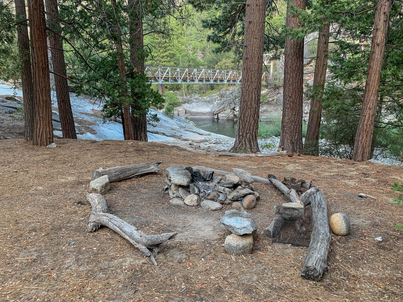
The best campsite I found was to the left when you exit the bridge. If doesn't suit your fancy there were a few more serviceable ones off to the right.
The biggest challenge here was just finding enough downed wood to have a campfire since the area had been picked over but I managed by climbing up the hill.
Day 9: Clover Meadow

Yesterday had been brutal. The terrain had had me fighting for every step despite the fact I'd mostly been descending. And I today I knew I had a long climb ahead of me.

Fortunately the trail was gloriously clear and easy to follow which combined with the fact I had more than enough food had me practically skipping my way up out of the canyon.


I've also decided I really need to do Balloon Dome. It's a damned impressive sight that just dominates the area.

My nice well traveled trail led me to a nice solid bridge across Granite Creek before joining dirt roads which I followed down to Clover Meadow.

Clover Meadow has a drive in campground which I've stayed at before and a small ranger station. I was a bit starved for conversation by now and I admit I was hoping to find the ranger in a chatty mood. Sadly it was closed on Tuesdays and Wednesdays so I had to settle for drinking my fill out of their water spigot and a few brief exchanges with people as I passed through the campground. Also it was apparently now squirrel season so I had to worry about hunters in the area.

The trail after Clover continues to climb up towards Fernandez Pass.

I found I had cell reception again and lost a bit of my momentum enjoying the views and checking in with some folks back home. At this point I was looking to be in good shape to finish the day after tomorrow so when I found a nice camp an hour and a half before sunset I decided to avail myself of yet another campfire.

The site I stayed at was located right at the trail junction which was a bit more public than I usually like but I didn't see a single person the entire time I was there. The next morning while looking for a place to dig a cathole I found a much nicer series of sites off to the northeast so if you're staying here I'd strongly recommend going over there.
Day 10: Fernandez Pass, Merced Pass

I had two passes and a bit of high country to get over before I'd be down by the Illilouette River and basically home free.
I loved the views as I climbed up toward the pass but despite the lack of people the area did feel a lot less remote than where I'd been the previous few days. I could periodically hear large trucks off in the distance and became used to the constant drone of airplanes overhead.

It was a solid climb up over Fernandez Pass but the fact I could see clouds building all around me kept me pushing forward despite complaining feet.

The area between the passes was really nice and if I ever do this again I'll plan to camp up here. Especially since once you are over Merced you're down in a burn area.


Merced Pass was gentle and forested making for a pleasant final pass.

Once I was across I was greeted by Mount Starr King off in the distance which happened to be the peak I was planning to lead right after I finished the TST.
From here it was all downhill except for an easy 2 mile climb to get to Glacier Point. I pushed on determined to find one last campsite with a fire pit which I managed right before dark. I had only 8 more miles between me and the end of the trail...
Day 11: Glacier Point, Yosemite Valley

...but as it turned out I I would end up doing a little extra to wrap things up.
The north terminus of the Theodore Solomons Trail is Glacier Point. It's a spectacular overlook with views of Half Dome and Yosemite Valley itself and tends to be one of those places where even a picture with the worst camera possible ends up looking amazing.

As I climbed the last two miles to Glacier Point I could see the start of the John Muir Trail down below where Jen and I had started late one Sunday evening way back in the beginning of August.

I was back in Yosemite after over 500 miles of some of the prettiest terrain the Sierra has to offer across the east and west sides. And I'd done the entirety of a trail that few people seem to have even written about which made me excited to share with my site and hiking friends back home.
Not to mention I had a well deserved beer and burger waiting for me down in the valley.

Glacier Point was somewhat of an anticlimax. I arrived to find the place was a zoo thanks to a citizenship ceremony they were holding. People and horses were running everywhere and the nice seat I'd been dreaming about in their little amphitheater was taken by the spectators.
The plan had been to meet my friends Jack and Rod here and get ferried down to the valley where we'd eat and pick up our permit for the Mount Starr King trip we were starting the following day. (It was going to be a relatively low mileage trip with a bit of technical rope work and a fun group of participants so I figured it would be a decent way to recover after the TST.)
I was able to text Jack and he told me he was about an hour away thanks to construction work on the road. It seemed a bit silly to just sit around up there when there were showers and more importantly beer just 4 miles below. So I shouldered my pack (which by now was again pleasantly light), texted Jack that I'd just meet him down in the Valley, and headed for the Four Mile Trail.


It was an easy walk but the amount of steep downhill did endup leaving me a bit sore which I found amusing after everything I'd been doing over the past few weeks.
I reached the bottom and decided a shower was the first order of business. A helpful park employee recommended using the ones at Curry Village instead of Housekeeping Camp so I jumped on a shuttle and headed over.
Unfortunately the showers at Curry all have a combination lock and the office where you can pay for a shower didn't have anyone in it. But I did make a friend who was nice enough to just give me the combo allowing me to enjoy a much needed shower.
The shuttles this year have been having a major issue running late and being overcrowded so I decided to just walk from Curry Village down to Yosemite Lodge where I was able to finally get that beer I'd been craving for the last hundred miles or so. What's another mile or two after all?

Jack and Rod soon found me and I companionably joined them in another meal, another beer, and some coffee. Unfortunately due to a miscommunication they'd still gone to Glacier and then had to drive all the way back down to the valley. After grabbing our permit and eating our fill we headed off to Mono Meadows where we would be meeting the group we'd be leading up Mount Starr King over the next three days. No rest for the wicked!
The Theodore Solomons Trail
So having now done the entire trail would I recommend it? Yes and no.If you've done the John Muir Trail or parts of the Pacific Crest Trail and found that to be difficult then this trail probably isn't what for you. It's longer, has more gain, and the terrain is just punishing for long sections. In addition the resupply logistic are a much bigger challenge than those trails.
Also the time when you can do this trail is limited thanks to the crossing over the Middle Fork of the Kings. Anything other than late summer you're going to risk not being able to get across unless you want to do what a few others have done and avoid that section completely.
But on the other hand if you're looking for a challenge and enjoy visiting some less traveled areas it's a great alternative. It passes through a lot of my favorite parts of the southern and western sierra and it'll give you an accomplishment that not a lot of people can claim.

To further illustrate just how few people have done the trail when I made a post on the Theodore Solomons Trail facebook group I was contacted by Gary Buscombe who wrote a the 1983 guide to the trail and he send me this awesome patch celebrating my accomplishment. What a guy!
Will I ever do it again? Probably not the entire route. Am I glad I did it? Absolutely!
3 comments
Thanks for this trip report. It’s definitely a trail I’d like to hike when the timing is right.
ReplyDeleteThank you very much for writing these reports. It is much appreciated. I've been thinking about taking a crosscut saw up to the section between Cassidy and Heitz Meadow and doing some work on the trail. It sounds like there's enough downed wood for several lifetimes of sawing.
ReplyDeleteWill be hiking from Glacier Point to VVR starting on 7/11/20. Thanks for the pointers about the rough sections around rattlesnake lake.
ReplyDelete