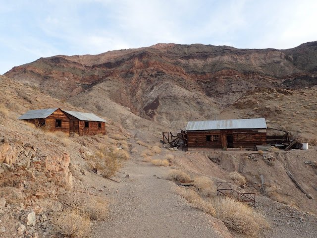
Baboquivari Bushwhack From Hell Via Thomas Canyon

December 31st, 2017
Baboquivari Southeast Arete
[Pics] [CalTopo] [Map]

Boboquivari is one of the more memorable peaks on the Sierra Club Desert Peak Section list.  It's spectacular to look at, fun yet not trivial to climb, and is also a painfully long drive from Orange County.

I've been up the Forbes route from the west twice before and I've been saying ever since that my next time up I wanted to do one of the technical routes.  This was an attempt at the Southeast Arete Route approaching from the east via Thomas Canyon.

The Southeast Arete can be done from either side I just wanted to see a different trailhead and as it worked out that this was only a short drive from Elephant Dome.

Beta on this side was somewhat mixed with some people claiming the use trail was good (it's not) and some citing challenging route finding.  It's quite possible the comments saying it's not bad are a bit outdated as we found the route to full of thorny vegetation that was almost impossible to avoid.  The more succinct comment I read about this side was a simple "Probably best approached from the reservation (west)" and I strongly agree.

Elephant's Trunk Route on Elephant Dome Mendoza Canyon Arizona


December 30th, 2017
Elephant's Trunk (5.7) on Elephant Dome  
[Pics] [CalTopo] [Map]

Wednesday I flew back in from spending Christmas with family in Texas and after two grueling days of life in civilization I was ready to get out again.  Fortunately that following weekend was a three day work holiday thanks to New Years and after some slightly harried planning I settled on a return to the Tucson area.

A few years back Jen Blackie, Jeff Atijera, and I did a New Years trip out there that had included caving, technical climbing, and even a facial assault by a skunk.  It was awesome except for that last part and the shots Jeff had to get to his face.  Beyond that the only other bummer was that we weren't able to summit Elephant Head due to route finding issues and an extended attempt to make something marginal work so I'd always wanted to go back.

Also since it's -ish in the area I wanted to add in one of the technical routes on Baboquivari since I'd heard it was an amazing climb.  Unfortunately due to the painfully long drives involved it's difficult to combine those two effectively with limited vacation days.

In the end we settled on driving out Friday night, not getting a lot of sleep, climbing Elephant's Dome on Saturday since it should have been an easier day, doing Baboquivari from the east the following day, and then if everything went well setting up for Elephant Head Sunday followed by a long drive home.  And hopefully not getting attacked by any skunks or drug runners.

It was an aggressive plan and things started going wrong also immediately when Kristen Lindbergh had to drop out due to some issued likely related to her unfortunate habit of consuming the flesh of innocent fish leaving just Jen and I leaving Friday night.

Enchanted Rock & Turkey Peak In The Texas Hill Country

December 26th, 2017
Enchanted Rock (1,825')
Turkey Peak (1,680')
[Pics] [CalTopo] [Map]

While a good number of my weekends are spent running amok in the outdoors Christmas is one that is always claimed by family.  And this year that meant a trip out to Texas.

I love spending time in Texas but the mountain climber in me is always a bit sad.  Other than Guadalupe Peak which is pretty much a New Mexico mountain that ended up on the wrong side of the state line the peak potential is pretty limited.

Behold a map of the 2,000+ ft prominence peaks in the US from http://www.cohp.org

A bit limited.  A few years ago when I was out this drove me to aim lower and look into county high point listing.  Behold where my grandparents live in Gillespie County.

Gillespie County High Point at Peakbagger

Yep, it's so flat out there that it lists 9 points as candidates for the county high point and a few of them involving trespassing.  I'd post the Texas prominence map but as near as I can tell no one bothered to make on.  You get the idea.

After discovering all of this a few years back I basically gave up on doing any satisfying inter family visit peakbagging and settled for visited the old standby of Enchanted Rock.

Fremont Peak & Red Mountain Mojave

December 17th, 2017
Fremont Peak (4,584')
Red Mountain (5,261')
Fremont: 1.4 miles, 750'
Red: 3.9 miles, 1,800'
[Pics] [CalTopo] [MapF] [MapR]

Yesterday our group climbed nearby Dome & Klinker Mountain before doing some sightseeing at the Owl in Red Mountain.  Today the plan was to start with Fremont Peak and then run over to climb Red Mountain and then hopefully make it home at a decent hour.

Since we camped right under the peak Saturday night this writeup covers the access and camping options rather than include them with the previous day.

Dome Mountain, Klinker Mountain, Steam Well Petroglyphs, and a Visit to the Owl in Red Mountain

December 16th, 2017
Dome Mountain (4,974')
Klinker mountain (4,562')
10.4 miles, 2,400'
[Pics] [CalTopo] [Map]

This trip came about thanks to Ross Doering who has been eyeing Fremont Peak for a while now since it sticks out rather dramatically along the 395 south of Red Mountain.


He mentioned it while we were driving back from a Sierra trip this summer and I jumped at the chance to lead something new.  So a few months later here we were with Dome Mountain, Klinker Mountain, and Red Mountain thrown in to fill out the weekend.

2017 Newport Beach Christmas Boat Parade Paddle

December 14th, 2017
[Pics]

Each year Newport Beach runs a Christmas Boat Parade for five nights in mid December.  Boats and yachts are decked in lights and decorations that vary from reasonable to full on pyrotechnic overkill and cruise around the harbor while the unwashed and slightly tipsy holiday masses watch from the shore or docked boats.

In 2014 Jen Blackie, Kristen Lindbergh, and I had bought our kayaks and started paddling around the harbor regularly after work.  When Christmas came around we decided to head out and join the parade with our kayaks and we ended up having an awesome time.

We were back out in 2015 despite it being a bit cold and *slightly* rainy.  In 2016 we had relatively good weather but returned to find Kristen's car had been broken into and her passport stolen.  Right before she was scheduled to fly out of the country.

This year marked our 4th time paddling out to join the parade.  For once the weather was damn near temperate and we'd done this enough to where we thought we had our plan down.  And then we checked and saw they changed the route.

Jubilee Mountain, Ibex Peak, & American Mine Death Valley

New American Mine entrance
December 3rd, 2017 
Jubilee Mountain (2,526')
Ibex Peak (4,751')
Jubilee: 2.16 miles, 1,200'
Ibex: 6.6 miles, 2,100'
[Pics] [CalTopo] [MapJub] [MapIbex]

Yesterday Jen Blackie and I climbed Ashford and Desert Hound peaks to the west and today we had a few other random peaks in the Zdon Peak List to choose from.  We decided to grab Ibex since I had seen the name pop up a number of times on Peakbagger radius searches and Jubilee since it was straightforward and along the way.  With the sun going down so early I figured we probably were not going to have time for anything else which did turn out to be the case.

We ended up spending extra time around Ibex due to the New American Mine / American Mine located on the southwestern slope.  We took a longer route to climb the peak and found one of the more extensive mines I've come across lately.

Ashford Peak, Desert Hound Peak, Ashford Mine Death Valley

December 2nd, 2017
Ashford Peak (3,547')
Desert Hound Peak (4,472')
7 miles, 4,000 ft
[Pics] [CalTopo] [Map]

I'd been back in civilization for a whopping four days following the epic six day Thanksgiving Turktacular trip to Escalante but an open weekend is an open weekend and I wasn't about to sit around at home. 

Since I finished the Sierra Club Desert Peak Section list last year I've been looking for new lists to work on and one of those has I've been toying with is the list of peaks which are in the Andy Zdon Desert Summits book.

Zdon Upper: http://www.peakbagger.com/list.aspx?lid=-924180
Zdon Lower: http://www.peakbagger.com/List.aspx?lid=-924181

The guide itself I've never cared for since it doesn't include any maps which makes it a lot of work if you are looking for things to climb vs checking for beta on a specific peak.  But hey, Peakbagger to the rescue and it is the closest thing we have to a Secor like reference to the desert.

Jen Blackie and I decided to head out to the cluster of peaks around Ashford Junction west of Shoshone and see what we could get done despite the short days this time of year.

On the plus side that meant the drive was only going to be about 4 hours which is a nice change of pace.  We might have even gotten to sleep before midnight *except* I managed to forget my boots meaning by the time we backtracked and grabbed them we didn't actually get away until 9 pm.  Ah well...

White Pocket Arizona (Rocks & High Point) - Turktacular 2017

November 27th, 2017
White Pocket (6,128')
3 miles, 1,000' -ish
[Pics] [CalTopo] [Map]

White Pocket is a remote grouping of dramatically colored rocks in the Vermillion Cliffs National Monument.  The area is better known for nearby attractions The Wave and Buckskin Gulch but due to the difficulty in getting permits for those more and more people seem to be aware of what White Pocket has to offer.

This was our second attempt to visit after the 2014 Turktacular found us out here on the final day only for me to be so floored by the sudden onset of the flu I wasn't safe to drive.  Considering the reputation of the dirt road used to access White Pocket we decided not to risk trying to have the girls drive it and instead spent the day in post Thanksgiving traffic getting back to LA.

Now it was three years later and we were back.

Smokey Mountain Road & Underground Coal Fires - Turktacular 2017

November 26th 2017
[Pics] [Map]

This was another travel day connecting the Hole In The Rock area of Escalante with Vermillion Cliffs so we could do White Pocket on our last day.  Along the way we visited a long burning underground coal fire and drove through some of the most remote areas of Escalante.

Red Breaks Slot Canyons Escalante Utah - Turktacular 2017

November 25th, 2017
11 miles, 1,400'
[Pics] [CalTopo] [Map]

After yesterday's rougher than expected climb of Fiftymile Mountain Kristen and I were both really excited to get back to more slot canyons.  And today was going to be the main attraction of the entire trip!

Red Breaks are some of the numerous slot canyons located in the area around Hole In The Rock Road though they seem to be less well known than a lot of others.  Yet when you're doing research on the area everyone talks about how they are the greatest thing out there.

And you can add this write up to that chorus of praise.  Compared with everything else we saw over the six days of the Turktacular this stands out easily.  We spent the day going up Red Breaks West and then down Red Breaks East and the route had everything from deep narrow slots, countless amounts of scrambling, tight squeezes, and two rappels.

In addition to where we came in Red Breaks can be accessed from the north along Spencer Flat Road though I really liked the way we did it.  Climbing up Red Breaks West let us do the more memorable of the two canyons first and then down East let us finish on the more technical one.

There's also an interesting geological formation you can access from the north end of the canyons called the Cosmic Ashtray.  We ran short of daylight but I would have liked to make an excursion in between the two canyons.

We left the cars at 10 am, reached Red Breaks proper around 12 pm, finished Red Breaks West around 2:45 pm, finished Red Breaks East around 4:30 pm, and returned to the cars around 8 pm.  But YMMV depending how long you want to spend taking pictures and how much trouble you have route finding.

Fiftymile Mountain Escalante Utah High ish Point - Turktacular 2017

November 24th, 2017
Fiftymile Mountain (7,641')
14.3 miles, 2,700'
[Pics] [CalTopo] [Map]

When we went looking for peaks to do out around Hole In The Rock the options were somewhat limited.  Pretty much all I had out here was Navajo Mountain and Mollies Nipple and other than that a big giant blank spot on my Peakbagger Master Peak Map.

We settled on Fiftymile Mountain because it's a significant landmark in the area and according to the limited beta we'd found we expected it to be relatively short with the crux just being the road up to the bench and the route through the cliff bands.  We had high hopes of getting back down in time to run over and do Spooky or one of the other shorter slot canyons.

It ended up being a little more involved after we didn't like the route we took up through the cliffs and went around the long way to hook up with a stock trail.  On the plus side it did make it a far more satisfying length hike even if the summit was dissapointing.

Zebra Slot Canyon Escalante Utah (Plus Bryce Canyon) - Turktacular 2017

November 23rd, 2017
5.6 miles, 500'
[Pics] [CalTopo] [Map]

Since we'd gotten off to a bad start and finished our 19 mile hike late the night before today was going to be a partial travel day taking us from our campsite near Kanab to Hole In The Rock Road in Escalante.  But we managed to fit in a quick visit to Bryce Canyon National Park and a quick run out to Zebra Slot Canyon before settling in for a Thanksgiving dinner.

Canaan Mountain Utah via Water Canyon and Squirrel Canyon Loop - Turktacular 2017


November 22nd, 2017
Canaan Mountain (7,363')
19.5 miles, 3,400'
[Pics] [CalTopo] [Map]

Every Thanksgiving I take advantage of the built in time off work to wander off into the desert and do a longer trip.  I call it the Turktacular and it's the perfect opportunity to escape a largely sedimentary holiday, send some time outdoors, and also enjoy a traditional -ish thanksgiving dinner prepared and eaten under the stars.

I've spent many of these trips out in Utah since there are just a disgusting amount of awesome things to see out there.  This year after much debate and planning Kristen and I decided to head out to the Escalante area with a few side trips on the way in and out.  Writeups for other days can be found under Turktacular 2017

This was the first of six days and we'd decided to start things off with a solid day of hiking and climb Canaan Mountain south of Zion.

Moapa Peak In The Nevada Mormon Mountains

November 19th, 2017
Moapa Peak (6,471')
7.1 miles, 3,500'
[Pics] [CalTopo] [Map]

Yesterday we climbed nearby Muddy Peak and camped along the road out through Buffington Pockets.  Today our goal was another nearby desert classic Moapa Peak.

Moapa is also on the Sierra Club Desert Peaks Section list and is notorious for its knife edge summit ridge.  It's also one of the best on the list in my experience and makes for a great combo with Muddy for a weekend of scramble peaks.

Muddy Peak In Clark County Nevada

November 18th, 2017
Muddy Peak (5,387')
9.2 miles, 3,200'
[Pics] [CalTopo] [Map]

As much as I really enjoy the volunteer classes I teach through Sierra Club they do wear on me a bit since they keep me in town during periods I'd rather by running amok in the wilderness (otherwise known as each and every damn weekend)  So it was with great relief I wrapped up my commitments last week and set about making some last minute desert plans.

Muddy and Moapa are two peaks on the Sierra Club Desert Peak Section list.  They are located north of Vegas along the 15 in the general vicinity of Valley of Fire.  They're both 3rd class (with Moapa in particular being known for an extended summit ridge with a bit of exposure) and are really quality examples of what the list has to offer.

We planned to drive out Friday night, climb Muddy Saturday and then camp along the road out, and then do Moapa Sunday before driving home.

Newport Harbor Pizza Paddle - Halloween 2017 Pirate Edition


October 31st, 2017
[Pics] [Map]

Once a month a group of us get together and paddle Newport Harbor after work. We launch from the beach next to the Newport Aquatic Center and paddle over to Pizza Nova in the main harbor in a combination of kayaks and SUPs. There we dock our boats, partake in feast of pizza and beer, and then paddling back to the cars. We do this all year round and in pretty much all conditions. Light, dark, rain, and the dead of SoCal winter where you're tempted to put a sweater on with your flip flops.

You can find writeups of other pizza paddles here.

It's been really hectic lately with all the trips, classes, and other events and so Halloween turned out to be the date that worked best in October.  So we did the logical thing and declared a pirate theme.

Sierra Club Wilderness Travel Course (WTC) 2017 - Kaweah Group


Past the break is a very long quasi chronological sequence of photos following the 2017 Wilderness Travel Course in Orange County with most being specific to Kaweah Group led by myself and Paul Warren along with a staff of extremely hard working volunteers.

For more information on what WTC is and how to take the course see the official site here. More posts on WTC by me can be found here.

This was the sixth year since we launched Kaweah Group as the third group in the Orange County section of the Wilderness Travel Course.  After having such a strong group in 2016 this year's had a lot to live up to.   Fortunately we ended up with an amazing group of people who blew us away the very first night with how much fun we were having and followed that up with one of the most active years on record.

This was also the end of an era as it was the last year volunteering for a good number of the staff including long time Whitney Group leaders Edd Ruskowitz and John Cyran and Kaweah staffers and personal friends Paul Warren and Laurent Hoffman.

Due to this 2018 will see Modjeska Group and Whitney Group being retired and the launch of two brand new ones named Olancha and Ritter.  And of course the concentrated awesomeness that is Kaweah will continue.

Sierra Club Advanced Mountaineering Program & Rock Checkoff - Fall 2017 aka AMP16

Fall 2017

The Sierra Club Advanced Mountaineering Program or AMP was started in 2009 by Dan Richter and Pat McKusky to teach basic and advanced mountaineering skills with the goal of promoting safe climbing and train a new generation of club leadership. While it's primarily targeted to Wilderness Travel Course graduates and Sierra Club outings leaders anyone is welcome. It's run twice a year in the spring and fall and staffed by an array of hard working volunteers many of whom are also WTC instructors and group leaders.

This was the Fall 2017 AMP class which is timed so that the Joshua Tree weekend happens at the same time the Wilderness Travel Course has it's graduation out there.  We also moved the Wednesday night class to a slightly more central location in Fullerton for the first time after historically having it on the north end of LA and we generally lucked out on weather.

The following covers the 4 official class outings plus the Rock Checkoff weekend which many AMP students attend to have what they learned during the course assessed.

Vogelsang, Florence, Simmons, Parsons, and Amelia Earhart Peaks Rafferty Creek To Lyell Fork Loop

September 30th to October 4th, 2017
Vogelsang Peak (11,493')
Mount Florence (12,561')
Simmons Peak (12,497')
Parsons Peak (12,147')
Amelia Earhart Peak (11,974')
Day 1: 12.5 miles, 3,300'
Day 2: 10.4 miles, 4,300'
Day 3: 8.7 miles, 3,500'
Day 4: 13 miles, 1,600'
[Pics] [CalTopo] [Map]

This trip was at the tail end of the Sierra summer climbing season slipped in right before the 3.5 week Advanced Mountaineering Program kicked off and kept me around town until well after the Sierra is usually choked with snow.  (Which of course means it's then time for desert adventures!)

The previous weekends trip to Mount Starr King was amazing but somewhat more of an organizational challenge vs a physical one so this was planned as one last good hard trip to finish off the season with a bang.  And damn did it deliver!

Mount Starr King Yosemite WTC Experience Trip

September 22nd to 24th, 2017
Mount Starr King (9,092')
Day 1: 10 miles, 1,800'
Day 2: 3.3 miles, 2,000'
Day 3: 8.2 miles, 1,700'
[Pics] [CalTopo] [Map]

Mount Starr King is a granite dome located near Half Dome and is one of the 247-ish peaks on the Sierra Club Sierra Peak Section list.  It's higher than Half Dome though it lacks the massive cliff overlooking Yosemite Valley which makes the other so iconic.

Also unlike Half Dome there are no cables or other mechanisms to get to the summit of Starr King except for doing a bit of 5th class climbing.  This means it's visited a lot less often than it's neighbor.

This would be the 4th time on the summit for Jack Kieffer and I.  We've been leading it biannually for a number of years now and have settled on a relaxed 3 day schedule camping well off the trail.  The nature of the climbing lends itself to being able to safely bring along a decently large group of varying experience levels which makes it ideal for an exciting Wilderness Travel Course Experience Trip.

This time around we had along a group of 16 people with an additional 30+ more who had requested to join but we didn't have room for them on the permit.  And this time it got interesting right off the bat when our trailhead ended up being closed due to to both being technically on fire while also covered in snow...

Koip & Kuna via Bloody Canyon Mono Pass WTC Experience Trip

September 16th & 17th, 2017
Koip Peak (12,962')
Kuna Peak (13,002')
Day 1: 8.4 miles, 3,300'
Day 2: 16.3 miles, 3,700'
[Pics] [CalTopo] [Map]

This trip came about as an attempt at finding something WTC Experience Trip friendly using a less heavily utilized trailhead without repeating a peak I'd done before.

Koip Peak is on the Sierra Peak Section list while Kuna is the 3rd highest peak in Yosemite behind Lyell and Dana.  Since the peaks are only about 500 ft apart they're easily done together once you get all the way up to 13k.  As an added bonus there's a plane wreck to explore on the saddle between them and some mining ruins at Mono Pass.

Mount Baldwin via Convict Canyon To Bright Dot Lake WTC Experience Trip

Red Slate from Mildred
September 9th & 10th, 2017
Mount Baldwin (12,598')
Day 1: 6.35 miles, 3,100' gain
Day 2: 10.93 miles, 2,500' gain
[Pics] [CalTopo] [Map]

Baldwin has been on my radar for a number of years.  It's most commonly done from the top of Convict Canyon which is an area I looked up at for years while fishing with my father at Convict Lake.  I finally got to go up there in 2010 when I led a trip to climb Laurel and Bloody.  The area was spectacular but the creek crossing on the way had caused us a bit of trouble.

Jeff Atijera and I had tried to do Mount Baldwin a few years later only to be told by the permit office that the stream crossing was too difficult and they wouldn't issue us a permit.

Kristen and I decided to try again this year scheduling it in September when theoretically the stream crossing would be at its most manageable.  And as an added plus we got a nice view of the peak from the top of Red Slate a few weekends before.

Looking at Mount Baldwin from Red Slate Mountain

Sierra Bivy Spots: Sherwin Summit

Inline image 2
Sherwin Summit 395 Bivy Spot
[Google Maps] [Sierra Bivy CalTopo]

Since I often have to leave after work to drive up to the east side for trips it's useful to have places suitable for throwing a sleeping bag out for a few hours for those really long haul drives.

This is one of my most heavily used spots for anything north of Bishop.  It's low enough to generally be free of snow and quieter than a lot of alternatives (as anyone who has slept in the Crowley Lake BM Campground and listened to cars drone by all night can attest).

Rodgers & Electra From Isberg Pass And Twin Island Lakes

September 1st to 5th, 2017
Electra Peak (12,442')
Rodgers Peak (12,978')
Day 1: 16.1 miles, 4,400'
Day 2: 7.3 miles, 3,100'
Day 3: 7.1 miles, 3,600'
Day 4: 15.4 miles, 2,100'
[Pics] [CalTopo] [Map]

Labor Day happen later enough in the summer that we're all usually in fairly good backpacking / climbing shape. After a particularly memorable outing to Seven Gables and Gemini a few years back a few of us made a minor tradition of going out and doing something fairly significant with the weekend.

Last year's Labor Day trip had been a rough one after we froze our butts off on Royce and Merriam and ended up coming out a day early. This time we were hoping for something a bit more pleasant.

Jeff hit on the idea of approaching the SPS peaks Rogers and Electra from the south via the Isberg Pass Trailhead. This had the advantage of being a less heavily used area (we barely saw anyone) and getting us a fair amount of new trail.

He did happen to slightly underestimate the mileage to Twin Island Lakes but hey, what's a few bonus miles between friends...

Duck Lake Peak & Pika Lake Loop WTC Experience Trip Costs Us a Vehicle

August 26th & 27th, 2017
Duck Lake Peak (12,051')
Day 1: 5.3 miles, 2,000' gain
Day 2: 11.2 miles, 3,000' gain
[Pics] [Caltopo] [Map]

Duck Lake Peak isn't on the Sierra Peaks List (or any other lists that than I'm aware of) but it's a moderately accessible named peak in a spectacularly beautiful area of the Eastern Sierra that lends itself to a two day overnight backpack with the option to camp beside a lake.  So pretty much exactly what I look for in a WTC Experience Trip except for the fact it's too high for campfires.

I was also particularly excited for this trip because we planned to hiked between trailheads of Lake Mary and Lake George in Mammoth Lakes.  I've been going to that area for fishing trips with my dad since long before I started climbing mountains and I was looking forward to finally getting a good look at the terrain I'd been staring up at for all of those years.

This was also the trip that resulted in Jen Blackie having to sell her trusty Toyota Scion after mechanical issues stranded us on the way back home.  Because you can't have things going too smoothly.

Newport Harbor Pizza Paddle - August 2017


August 25th, 2017
[Pics] [Map]

Once a month a group of us get together and paddle Newport Harbor after work. We launch from the beach next to the Newport Aquatic Center and paddle over to Pizza Nova in the main harbor in a combination of kayaks and SUPs. There we dock our boats, partake in feast of pizza and beer, and then paddling back to the cars. We do this all year round and in pretty much all conditions. Light, dark, rain, and the dead of SoCal winter where you're tempted to put a sweater on with your flip flops.
You can find writeups of other pizza paddles here. For notifications on when we're doing the next one see our facebook group Pizza Paddle Associates. (Send me a message so I know you're not a spam bot!)

It's getting towards the end of summer but we're still launching in daylight for a bit longer.  And of course I'm in the Sierra most weekends so it gets hard to schedule these!

Hengst & White Chief Mineral King WTC Experience Trip

August 18th to 20th, 2017
Hengst Peak (11,146')
White Chief Peak (11,159')
Miners Ridge (10,823')
Miners Nose (9,423')
Day 1: 6.4 miles, 2,100'
Day 2: 7.7 miles, 2,400'
Day 3: 6.4 miles, 700'
[Pics] [CalTopo] [Map]

I'd been back in town for three whole days following last weekend's trip to Red Slate so of course I was chomping at the bit when Thursday night came around and it was time to head for Mineral King!

This was a repeat of a trip I'd led back in 2011 which I'd really enjoyed despite suffering through legions of mosquitoes.  In addition to including my namesake peak it's just a really pleasant three day trip on the easier end and the Mosquito Lakes area seems to be a little less trodden than a lot of the other areas where we run comparable experience trips.  And of course it's Mineral King so the views are always spectacular.

Bivy Spots: Joshua Tree

Joshua Tree Bivy Spots
[Caltopo Map]


Camping in the desert is usually really easy.  Drive to the desert, find a spot that isn't a road or private property, and throw out your sleeping bag!  However certain areas like Joshua Tree can offer some challenges since it's a National Park surrounded by housing and the campgrounds all have a bad habit of filling up early.

The following are a few locations near Joshua Tree that I've used in the past.

Red Slate Mountain WTC Experience Trip

August 12th to 14th, 2017
Red Slate Mountain (13,123')
Day1: 12.5 miles, 4,200'
Day 2: 7 miles, 3,000'
Day 3: 12 miles, 1,500'
[Pics] [CalTopo] [Map]

Red Slate is another one of those peaks that I've had on my radar for a number of years there was always some reason it didn't happen.  There's also the rather rad looking technical snow route from the north that was always damn tempting to attempt vs the walkup route from McGee Pass or Lee & Cecil Lakes.

But this year I was on a roll and looking for non repeat trips that would work as Wilderness Travel Course Experience trips.  Red Slate makes for an almost ideal 3 day that gets you over the Sierra crest and has the added advantage of taking you up McGee Creek which is one of the more spectacular trails on the east side.

So when Ross Doering showed interest we threw together a trip and a few short -ish months later we were off!  We'd planned it for August figuring the snow on the pass wouldn't be an issue but the winter of 2017 turned out to be a very high snow year with snow lingering until the end of summer.

Goat Mountain WTC Experience Trip

August 5th & 6th, 2017
Goat Mountain (12,207')
Day 1: 9.4 miles, 5,600'
Day 2: 12.5 miles, 1,800'
[Pics] [CalTopo] [Map]

After last weeks car stranding adventure in Mineral King I was looking forward to a nice straightforward buttkicker.

Enter GOOOOOOOOOOOAT!  Two days!  One peak!  5k up the first day followed by 2k up and 7k down the second!  Most of which was to be done with full packs.


Despite some initial skepticism potential participants were eventually won over by my constant wandering around yelling GOOOOOOOOOAT! at them and we ended up with 11 people meeting us at the trailhead at the end of the 180.

Vandever Mountain, Cirque Cave, & White Chief Caves In Mineral King WTC Experience Trip

July 28th to 30th, 2017
Vandever Mountain (11,947')
Cirque Cave
White Chief Cave
Day 1: 4.5 miles, 1,900'
Day 2: 5.48 miles, 2,700'
Day 3: 2.85 miles, 0'
[Pics] [CalTopo] [Map]

The first thing that always occurs to people when you mention Mineral King is the ever present threat the marmots pose to vehicles left at the trailhead.  So when I say we ended up with a vehicle dead in the water and having to be towed down you (and my Facebook feed) would probably assume marmot damage.  Aaaand you'd be wrong...

This trip was heading in specifically to climb Vandever Mountain which Kristen and I previously attempted in 2014 and failed when we couldn't find a route up the northern ridge.  This time we were planning to do the allegedly 3rd class (it's not) northwestern ridge and use the approach as an excuse to look at the White Chief Cave system.  I wasn't expecting too much there but it ended up being the highlight of the trip!

Mount Warren Via Lake Canyon And Lake Oneida WTC Experience Trip

July 22nd & 23rd, 2017
Mount Warren (12,327')
Warren Fin (12,160')
Day 1: 3.9 miles and 1,950'
Day 2: 10.06 miles and 3,000'
[Pics] [Caltopo] [Map]

After last weekend's mosquito fest of an attempt on Stanford North was turned back by snow I was just a bit concerned for this weekend's trip to Warren.   But not enough to do something drastic like not go to the mountains of course.

Mount Warren seems to be done more popularly as a dayhike from Tioga but there's a route up from Lundy that climbs Lakes Canyon past a really nice lake called Oneida.  Even better the trailhead is non quota and you're allowed to have campfires.  Mileage was extremely reasonably making it seem like an ideal candidate to make a two day WTC Experience Trip.

Newport Harbor Pizza Paddle - July 2017

July 20th, 2017
[Pics] [Map]

Once a month a group of us get together and paddle Newport Harbor after work. We launch from the beach next to the Newport Aquatic Center and paddle over to Pizza Nova in the main harbor in a combination of kayaks and SUPs. There we dock our boats, partake in feast of pizza and beer, and then paddling back to the cars. We do this all year round and in pretty much all conditions. Light, dark, rain, and the dead of SoCal winter where you're tempted to put a sweater on with your flip flops.

You can find writeups of other pizza paddles here. For notifications on when we're doing the next one see our facebook group Pizza Paddle Associates. (Send me a message so I know you're not a spam bot!)

It's prime time for after work paddling right now since we get to launch in the light and enjoy a sunset on the way to pizza.  It's also prime time for Sierra backpacks so everyone seems extra busy!

Stanford North WTC Experience Trip Attempt with Too Much Snow

July 15th & 16th, 2017
Mount Stanford (Attempt) (12,838')
[Pics] [CalTopo] [Map]

Thanks to the heavy snow year regular backpacking trips to the Sierra had been pushed back a bit.  But here we were in the middle of July which is when I'd conservatively hoped the snow would be manageable and it was time to finally start climbing high!

This was also a Sierra Club I provisional for Gracia Plascencia.  I was here to eval which is why I was attempting this peak for a third time.

The first time I turned back 200 ft from the summit with some students who were really struggling and ended up not getting them back to the trailhead until midnight and not getting back to Orange County until 6 am.  The second time I made the summit only to be nailed by a rainstorm which proceeded to soak us for the entire 5 hour hike out.  Then there was this trip where the mosquitos were epic, we nearly lost someone during a stream crossing, and we couldn't summit due to a section of steep snow.

I'm really starting to think this area is just bad luck for me...

Adams Peak Furthest North of the Sierra Peaks List

July 4th, 2017
Adams Peak (8,197')
5.75 miles, 1800'
[Pics] [CalTopo] [Map]

This was the fifth and final day of our big 4th of July road trip where we visited Trinity Alps, Lassen Volcanic National Park, and Adams Peak which is the furthest north of the Sierra Peak Section list.  Writeups of the other days can be found here.


Adams is the green dot north of Reno and as you can see it's waaaay up there and kind of on it's own.  We'd originally planned to do several of the SPS peaks up here before deciding Trinity Alps and Lassen NP sounded a bit more exciting.  But this one being all by itself and not that long or challenging it made sense to grab it on the last day so it wasn't just all driving.

Lassen Peak From Bumpass Hell In Lassen Volcanic National Park

July 3rd, 2017
Lassen Peak (10,457')
6.5 miles, 2500'
[Pics] [CalTopo] [Map]

This was the fourth day of a big 4th of July road trip where we visited Trinity Alps, Lassen Volcanic National Park, and the furthest north of the Sierra Peak Section list.  Writeups of the other days can be found here.

After yesterdays climb of Brokeoff Mountain the plan for today was to get an early start and climb Lassen Peak and then relocating to get set up for Adams Peak the following day.

Brokeoff Mountain Lassen Volcanic National Park

July 2nd, 2017
Brokeoff Mountain (9,235')
Broke Off Mountain NW Summit (9,200')
7 miles, 2700'
[Pics] [CalTopo] [Map]

This was the third day of a big 4th of July road trip where we visited Trinity Alps, Lassen Volcanic National Park, and the furthest north of the Sierra Peak Section list.  Writeups of the other days can be found here.

After spending a really pleasant night near the top of the road leading to the Weaver Bally Fire Lookout we packed up in the morning and headed for Lassen.  (Fortunately driving down the dirt road in a passenger car was a lot easier than getting up it.)

Monument Peak & Weaver Bally In Trinity Alps

July 1st, 2017
Weaver Bally Lookout (6,988')
Weaver Bally (7,493')
Monument Peak (7,762')
[Pics] [CalTopo] [Map]

This was the second day of a longer 4th of July trip which visited Trinity Alps, Lassen Volcanic National Park, and the furthest north of the Sierra Peak Section list.  Writeups of the other days can be found here.

Today the main goal was Monument Peak in a nearby area of Trinity Alps.  And since it was an easier day we finally had a chance to catch up after two very long days with very little sleep.

Canyon Creek Trail Trinity Alps Sawtooth Attempt

June 30th, 2017
Sawtooth Mountain (Attempt) (5,700')
18 miles, 3,200'
[Pics] [CalTopo] [Map]

This years 4th of July trip was a 1680 mile loop visiting Trinity Alps, Lassen Volcanic National Park, and grabbing the furthest north of the Sierra Peaks Section list.


First off was Trinity Alps which is one of those areas I've heard of but had yet to visit and uur first day would be spent on an aggressive attempt to dayhike Sawtooth Peak.   The reports from rest of the trip can be found here.

Hockett Peak WTC Experience Trip

June 24th & 25th, 2017
Hockett Peak (8,552')
Day 1: 9.25 miles, 2000'
Day 2: 15.3 miles, 4200'
[Pics] [CalTopo] [Map]

Iiiiiiit's Sierra trip season!  Kind of!

Hockett isn't on any peak list I'm aware of it's just one of those out of the way named bumps that is just prominent enough to make it interesting.  I've been eyeing it for a few years but it was always an aggressive bonus peak on longer trips and never worked out.

So we decided to make a weekend out of it.  The Jerky / Lloyds Meadow trailhead is nice because it's a non quota trailhead that seems to open relatively early compared with some others in the area *and* the only major stream crossing has a bridge!  Perfect for an early season backpack.

The only downside is you need to get there before it gets to warm and we were pushing it here going in late June with forecasts going into the 90s thanks to a heat wave hitting California.  But we figured we could manage.

Crag USGS & Deer From Kennedy Meadows WTC Experience Trip

June 10th & 11th, 2017
Crag USGS (9,440')
Deer Mountain (9400ish)
Day 1: 14.7 miles, 4,800'
Day 2: 12.9 miles, 2,000'
[Pics] [Caltopo] [Map]

This trip was originally a two day to Kern Peak led by Garry McCoppin and Ross Doering.  That changed to Deer and Crag after the trailhead for Kern still wasn't opened a week before the trip.  And then when Garry needed a last minute replacement leader I jumped at the chance to get out from under the aftermath of moving the previous weekend.

I'd already been out this same trail just one month earlier scouting route options on Crag which was a bit of a bummer but on the other hand I already knew a really nice campsite and a pile of firewood that hasn't been used.  And as this trip was primarily intending as a Sierra Club Wilderness Travel Course experience trip we had a nice diverse group.

Friday night 13 of us drove for Kennedy Meadows and spent the night at the campground.