Section Hiking The Condor Trail: Lower Rancho Nuevo to Piedra Blanca
- Updated: April 22, 2020
- Post By: Matthew Hengst

April 22nd to 26th, 2020
48 miles, 7,000'
I'd now been backpacking the Condor Trail since April 9th. I'd started at the northern terminus doing 85 miles Section Hiking The Condor Trail: Bottchers Gap to Kirk Creek and then when they closed some of those trails I jumped south for another 58 miles Section Hiking The Condor Trail: Cuesta Pass on the 101 to Adobe TH on the 166.
Now I only had about 5 days left before my Pacific Crest Trail plans were starting. Jen and I had booked an Airbnb for a week starting on April 27th so that I would have a chance to recover before kicking off what was potentially 5+ months of nonstop hiking on May 5th.
I'd originally eyed continuing the last section and coming out at Manazan but Brian Sarvis had described the trail as involving some significant bushwhacking and as much as I was enjoying the solitude I was really hoping to get in more hiking and less manual tick removal to better prepare for the PCT.
I also debated doing Piedra Blanca to Lake Piru allowing me to see the southern end of the trail but that also reportedly had some bad sections.
I decided to do the section from Tina / Lower Rancho Nuevo along the 33 down to Piedra Blanca aka the trailhead most people use for Sespe & Willett Hot Springs.

So this time I did the yellow section of the map above and while there was still some significant brush and an ungodly amount of ticks it was another enjoyable section of the Condor Trail.
Day 1: Hiking Back In

This was a late start. I'd already spent that morning hiking 7 miles out of the last section and I was now pleasantly stuffed after devouring a meal in nearby Ventucopa. Our plan was for Jen to join me as I hiked in a few miles to the first camp then she'd come out early the next morning.

The trailhead was easy to find and there was ample parking in the small dirt lot. It would have made for a decent trailhead bivy camp if we hadn't been looking to start hiking.

We started hiking at 6 pm and followed a blocked road from the trailhead and across a large sandy wash punctuated by multiple muddy streams. These were just deep enough that we had to resort to a shoes off crossing at one point.

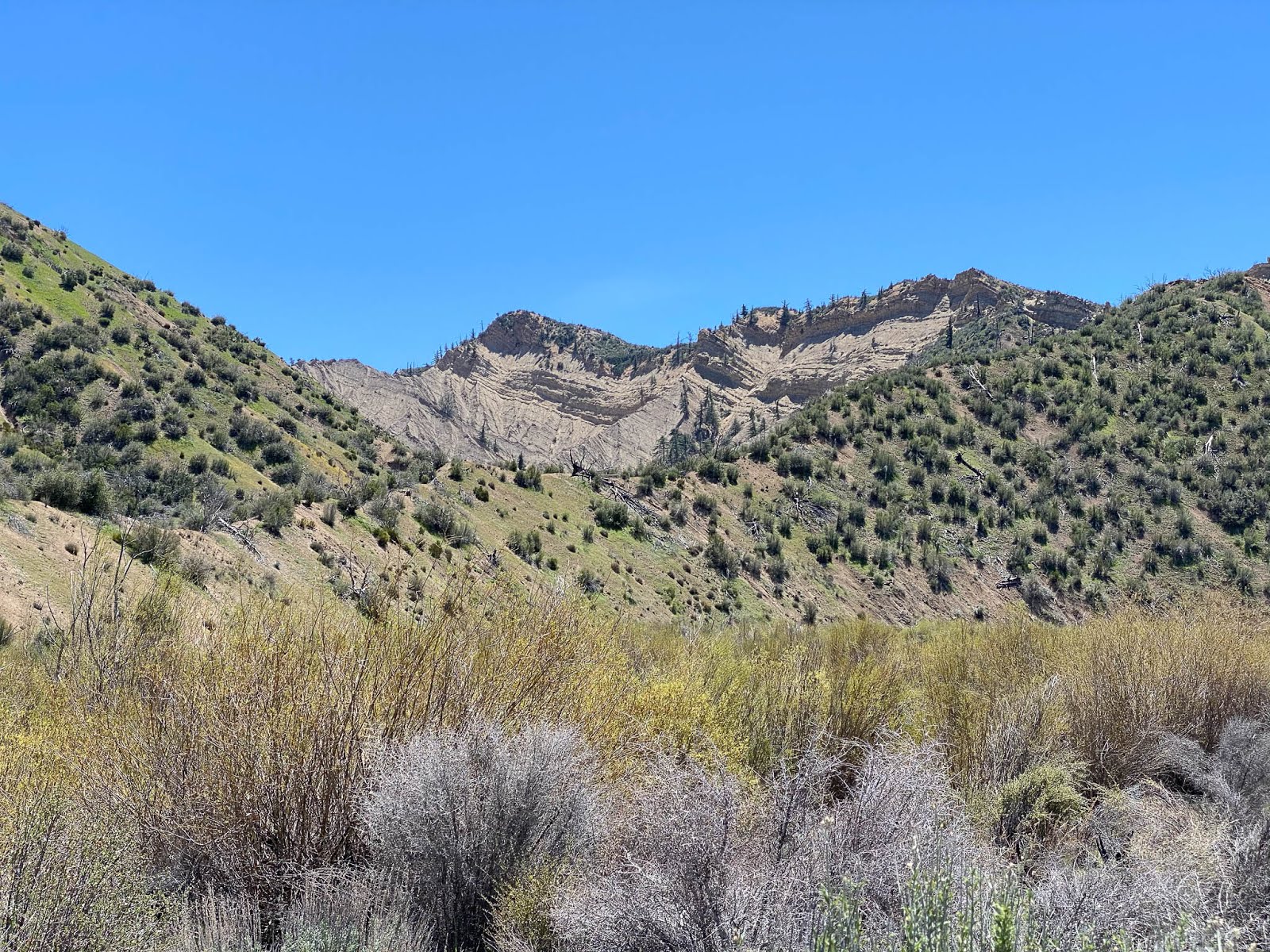
Soon after we entered a large canyon with extensive vegetation and blooming flowers off to either side.

We reached the Lower Rancho Nuevo Campground a little after 7 pm and found that despite being well signed the old sites were overgrown and any of the formerly flat tent areas seemed to have been extensively dug up by animals.
We settled for pitching the tent right at the end of the the old road tracks and settled in. We were still full from our burgers earlier so we spent a while just relaxing and watching the bats fly around eating bugs before crawling into our sleeping bags.
Day 2: Upper Rancho Nuevo Exploration

Jen left before dawn while I spent another pleasant morning sipping coffee and watching the sun come up.

The downside of picking this section was that it was a bit short assuming I just stuck to the trail. So I'd decided to do a side trip out to explore the canyon last Upper Rancho Nuevo where there was supposed to be an area described as a mini Zion.

I was in great spirits on the initial section of the canyon. The brush overgrowth was minimal meaning I only had to keep the occasional eye out for ticks and I loved the effect of the trees growing up the canyon walls.

There's a not so great campsite at Deal Junction and here I turned west and followed a slightly less established trail out to Upper Rancho Nuevo.

The trail varied in quality but it was a step down from the main trail in Deal Canyon. The ticks were also out in force here and I set several high scores as I stopped past every bush to pick / flick them off my pant legs and shirt.
Another challenge was the sand around some of stream crossings was hyper saturated. At one point I took a step and quickly sank down past my ankles.
I arrived where the map said the Upper Rancho Nuevo Camp was and found...not a lot. I never saw an established campsite though there were plenty of flat areas where someone could have camped if they wanted. I also found cached camping gear wrapped in a blanket in an alcove a short distance before the camp.
Incidentally I did come across the sign for the Upper Rancho Nuevo Camp later on. It was leaning up against the outdoor shower at the Ozena Fire Station down along the 33. Go figure...

I explored further back in the canyon but it was slow going. There were enough discarded plastic bottles everywhere that it was clear that people had been this way before but what passed for a use trail kept disappearing into heavy brush. Lacking anything to cut through said brush and not knowing precisely how far back the supposed Mini Zion was I eventually decided to turn back.
(If you have any pictures of the area up the canyon please send them to me as I'd love to know if it's worth a visit)
By the time I made it back to Deal Junction Camp it was getting near time to stop for the day. I'd intended to stay there and maybe take advantage of the firepit but the wind was howling there was once again a distinct lack of suitable tent spots.

I ended up continuing for a few miles until I reached a wide spot in the canyon where I found some sandbars that were better suited for camping.
Day 2: Back to 33 and Starting Up Pine Mountain

My feet were in rough shape this morning possibly due to the extended time they spent wet when I'd accidently encased my boots in mud the previous day.

After leaving my sandbar the canyon turned east and opened up a bit which was where the trail started to become hard to follow again. I kept an eye on my gps and did my best to stick as close to the track as I could since I generally regretted things when I got too far off.
While walking along a row of bushes I heard the distinct hiss of a rattlesnake go off somewhere nearby. I jumped back, and then jumped again as I struggled to figure out which bush the noise was coming from. Finally I caught site of the large rattler coiled in the shade and hustled past.
Soon after I met two older ladies who were out backpacking with their dog. They said they'd come in from the east and were planning to camp at Deal Junction and explore Upper Nuevo. I related my experiences and gave them my recommendation on camping at the sandbar.

After climbing over a small ridge the trail rejoined 33 once again. It was so warm that I had spent the last few miles fantasizing about the cold beer on tap at The Place and I actually texted Jen via InReach to see if she was anywhere nearby. Sadly she was still down in Orange County so I had to stick with the lukewarm creek dregs in my smartwater bottle.

After a stretch walking along the side of the 33 being passed by the very occasional vehicle I reached the Ozena Fire Station where the next section of the trail started.

I went through a gate at the back of the station and started climbing a pleasantly established trail. (Notice that the more I'm out here the happier I am for any break from tick infested brush)

Other than the lack of water and the fact I was dragging a bit at the end of a long hot day this was a pleasant climb. I love trails with steady climbs that let you just put your head down and enjoy the exertion.
I knew the following day would be dry and I needed water so I aimed for the camp at McGuire Spring.

The junction leading out to McGuire Spring is shown above. It was a short distance above where it was shown on the map and followed a fairly clear trail as it crossed several canyons.

The camp itself had seen better days thanks to a rather large tree having landed practically on top of the firepit.

Initially I thought this hole was the spring and I wasn't relishing drinking out of it even after running it through my filter. I've found that while they will tell you that the Sawyer / Katadine / MSR filters commonly used in CA will filter out anything harmful in the water it tends to still come out with an unpleasant tinge if if the source is bad enough.

I spent some time looking around up the slope and had all but given up and was returning to the hole to filter when I caught sight of this box which appeared to be the spring proper. It was a bit slimy inside but lacked the oily sheen of the hole.
Assuming you're standing at the firepit facing down the slope the bad water source was down and to the right while the spring box was down and to the left.
I wasn't feeling great so I didn't bother with trying to have a fire and just went about making dinner and turning in for the night.
Day 4: Up And Over

Today I was passing along the high point of the Condor Trail and I knew I'd be spending the entire day up on the ridge without water. My goal was to make it up and over to Haddock Camp where Jen planned to hike in and meet me so we could do the last day together.
I did my best to get down as much water as I could last night and this morning since I knew would be a hot dry day. Unfortunately I'd started to have some intestinal issues and I was having trouble getting down enough water. I suspected I might have ended up ingesting some e. coli back during the cattle heavy section of the trail when I'd fumbled a bottle during an attempt to filter but there was nothing to do but make the best of it.
Once back on the main trail it continued climbing until it dumped me out along the top of a ridge where it joined a paved road.

Pine Mountain is a full on developed drive in campsite. Some of the sites still had the Open / Reserved tags on them from November / December time frame and the pits and signs had all been wrapped in trash bags for the winter.
The only thing it was lacking was water but I was just grateful for the open and stocked porta potties I found here, at Reyes, and at the TH at the end of the road.

I ate a quick lunch of raman at the campsite since it was one of the few things I was able to get down and pushed on up the road. I hadn't seen a single person since leaving the 33 until I came across a tent set up amongst the rocks at Reyes Campground. I ran into the owners a mile later at the Reyes Peak TH. It was a pair of guys who had just hiked up the road from the 33 to spend a night or two backpacking. They commented that they'd brought way too much stuff and that they were surprised no one else was up there. They also shared a bit of their extra water which was a nice gesture.

After that it changed back to a trail proper. And since I was now up past 7,000' I even had some snow to deal with. It covered the trail in a few different places leaving me postholing across hillsides but it was never enough to cause a real challenge.
It also wasn't enough to be melting in a way I could collect for drinking.

At the far end of the ridge the trail passed Haddock Peak and then dropped down offering me some really great views of Sespe.

As promised Jen had hiked into Haddock to meet me and I found her happily daydreaming in the shade. She had hiked in the day before from Piedra Blanca where she'd camped about a mile in and then hiked the rest of the way to Haddock that morning. She had also at my request brought in one of our goto trail treats of red wine, fancy cheese, and tortellini which we set into with much enthusiasm.
Day 5: Out At A Busy Piedra Blanca

I'm not saying the wine last night magically cured me but it did taste amazing and I was feeling a lot better after having eaten.
We now had a bit of a decision to make. Technically we didn't have anywhere to be until tomorrow at 4 pm when we could check into our Airbnb. But we only had about 10 miles to get out and a lot of that was reportedly good trail and descending.
We debated camping near the trailhead vs hiking out and eventually the latter plan won on account of me feeling very predisposed towards real food and a shower.

The initial few miles of the trail just involved picking our way along the canyon. A few times we were talking and managed to get off the trail and only small game trails which would then peter out in the vegetation forcing us to backtrack. There were also numerous stream crossings including the occasional one that required a boots off crossing.

The trail showed signs of having been massively cut back recently which was well appreciated. It was still overgrown in places and the ticks were out in force as Jen found out when I stopped to flick several off my own clothing.
"I don't think I have any" she said looking down at her dark blue capris
"Then what's that, and that, and that? And there's a bunch on the back of your leg also"
"AAAAAAAAAAAAAHHHH!"
I was pretty much numb to the routine by this point and settled back into the rhythm of systematically flicking crawling ticks off my shirt and pants anytime I came near any vegetation.
Later on down the trail we stopped for a swim and as we stripped down I pointed out a dark spot on Jen's hip. She'd already managed to get a tick dug into her belly button a week ago and now it looked like she managed a second one while I'd been covered in them for weeks and somehow avoided any bites.
She responded with a shriek and went to work yanking the pieces of tick out of her side and loudly exclaiming about how disgusting it was.
(For the record my closest call was picking a tick out of the bottom of my underwear one morning)

I meanwhile went about frolicking in the water. It was slightly too cold to be comfortable but it felt glorious once I plunged myself in and cleaned off the top few layers of dried sweat I'd been accumulating for the last few days.

Soon after that we saw our first tent off to the side of the trail and before long we were passing multiple groups. I believe I saw more people in the last mile or two of this trail than I did during the rest of my 17 days combined. And unfortunately since a lot of them seemed to be city folk fleeing the pandemic there was a distressing amount of trash and abandoned clothing spread about.

With visions of a post trail meal and shower driving me forward we did the last crossings to reach the parking lot.

The Sespe area is spectacular and I highly recommend a trip out to the hot springs. Just not right now because it's a bloody zoo.

Thanks to the pandemic closures they locked the bathrooms and stopped trash service but didn't close the road or parking lot. As a result people were making a bit of a mess.
Sadly our mad dash back to Ventucopa was in vane as they had already closed. Though I do give them credit for letting us in 40 minutes after closing to sell me a cold beer to go.

We managed to find a surprisingly good Mexican restaurant in Taft that was serving food to go and ate in Jen's car while researching potential camping options. After finding all the good options required some significant backtracking we decided to just splurge and get a $40 motel in Buttonwillow for the night. (In retrospect there may have been less bugs sleeping out at a trailhead)

And then it was off to Visalia the next morning for a week relaxing and letting my feet heal up as best they could.
Next up: I kick off a little trek along the Pacific Crest Trail...
0 comments