Mount Baldwin via Convict Canyon To Bright Dot Lake WTC Experience Trip
- Updated: September 09, 2017
- Post By: Matthew Hengst
September 9th & 10th, 2017
Baldwin has been on my radar for a number of years. It's most commonly done from the top of Convict Canyon which is an area I looked up at for years while fishing with my father at Convict Lake. I finally got to go up there in 2010 when I led a trip to climb Laurel and Bloody. The area was spectacular but the creek crossing on the way had caused us a bit of trouble.
Jeff Atijera and I had tried to do Mount Baldwin a few years later only to be told by the permit office that the stream crossing was too difficult and they wouldn't issue us a permit.
Kristen and I decided to try again this year scheduling it in September when theoretically the stream crossing would be at its most manageable. And as an added plus we got a nice view of the peak from the top of Red Slate a few weekends before.
Permits are limited with only 6 reservable per day. However Inyo does allow Sierra Club and certain other groups to borrow permit slots from the following day which allowed us a respectable 12 permit slots.
We left OC after work and spent the night at the usual spot behind the Sherwin Summit sign. Saturday morning we woke up early and drove in to Convict Lake.
We initially planned to stop in at the East Side Bake Shop again and grab coffee. But when we pulled up we found the place closed down after Labor Day. Doh!
Having been anticipating a warm breakfast we were happy to discover there was a burrito truck parked in front of the Convict General Store just past where our trailhead was. The burritos were decent though the coffee was sadly about what you would expect from a gas station.
The backpacker lot for Convict is actually almost a quarter of a mile north of the lake. That includes one last hill you have to crawl up on the way out just when you think you're done. There are no bathrooms or bear boxes here so you have to deal with all of that elsewhere. (Trashcans and flush toilets can be found at the Convict General Store)
Day 1: Shortcut To Bright Dot Lake
We started hiking at 8:15 am and took the trail around the north side of the lake to the junction where it starts climbing in earnest.

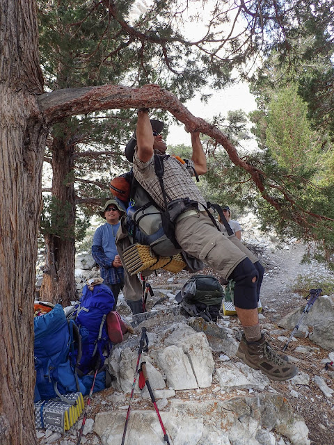
This being Victors 17th experience trip he felt the need to show off a bit and proceeded to do some pullups *with his pack* while we were waiting for the back of the group.
The big question mark for the day was of course the water crossing. There had been a bridge here at one point but it washed away years ago. Both times I've been here the amount of water coming down hasn't been the issue so much as how polished all the rocks are.
We came prepared with crocs and hiking poles anticipating a boots off crossing but we decided to look around a bit first and see what our options were.
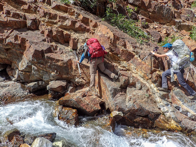
I could see a few options further up the canyon that looked promising so we crossed the stream ahead of us about 40 ft up the side canyon. A combo of rocks and logs made it easy.
The second part took a bit more care.
The best option I could find was to climb out to this rock and do a big step across.
A few people got their boots a little wet but we made it through generally unscathed.
 |
| Victor crosses the creek dramatically. Picture by Randy de los Santos |
At this point a trio of fisherman had come up the trail behind us and were watching as we crossed. It turned out the back of our group had had a little encounter with these guys earlier. They had been a switchback below our sweep when they called up asking if the trail they were on connected where we were. Our folks answered yes and started to explain why cutting switchbacks is a bad thing to do when the guy cut the switchback and exclaimed "I'm sooooo sorry. I'd never normally do that sort of thing" in a jerkish manner.

So they were dicks. Fortunately universal karma was in effect on this particular day as we saw them fall in several times during the initial step across and then several more times when trying to cross the log. The last we saw them they appeared to be having quite a time loose rocks on the trail past the crossing. Such a shame...
Technically went off trail during the next section as I followed a series of cairnes down by the water. This worked but on the way back we found there was a clear trail higher up the slope and I'd just missed the turn.
When we planned the trip we thought Bright Dot Lake looked like the best camp spot. Depending on how the group was doing we planned to either climb directly from the trail to the north shore of Bright Dot Lake (which was short but steep) or possibly go past Mildred and either camp there or swing around the back side of the lake which was longer but reputedly an easier hike.
Everyone was doing great (-ish) so we enthusiastically went for option #1. I kept us on the trail as high up as we could and then began the bushwhack.

In retrospect it was a mistake not to leave the trail earlier.
This is the view looking up from below. The green patch on the left of the picture is what you want to aim for. Once you're there it's still cross country scrambling but it's clear of vegetation and relatively solid. Which was not the case with the higher route we took. But hey, live and learn!
I've seen descriptions elsewhere that talk about this section as having a route up to Bright Dot but no trail and that's pretty accurate. We found occasional cairns but it didn't feel like many people had been up this way.
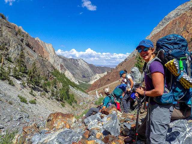
It was about a mile from where we left the trail to the lake and it got noticeably easier the higher up we got. We had one person feeling some altitude issues so we slowed down a bit and took the opportunity to enjoy the views
Hard life!
Bright Dot is somewhat stark but but it had an amazing view looking south to Baldwin and Red Slate. There was a established campsite right by the water that we used for our happy hour and everyone scattered further to the north where we found plenty of sites for our tents and bivys.
We arrived at Bright Dot around 4:15 pm and the weather was looking slightly threatening. We only had a 20-30% chance of precipitation according to the forecast but I'm somewhat notorious for attracting bad weather so people hustled to get their tents up.
We had the lake to ourselves though one of our folks convinced there were people up on the hillside wearing camo and sleeping under tarps. As near as we could tell that wasn't the case...
On last weekends trip Victor and Jen had decided to team up for happy hour and the result was some quite impressive chicken mole tacos.
In addition we'd brought a few libations along and Victor ran up the hill to grab snow so we could turn the lid of one of the bear vaults into a makeshift beer chiller again.
Also this happened.
Everyone was tired after the late night drive and it was starting to get quite chilly in the evenings now that fall was almost here. So as soon as the sun went down everyone crashed.
Day 2: Summit And Out
The peak was only about 1.25 miles from where we camped and theoretically the hike out was going to be easy (at least according to Kristen) but we still did our usual early morning start.
 |
| First light on Baldwin (left) and Red Slate (right) |
It was also pretty damn cold. At least for everyone except Halley who was running around in shorts.
Once we were on the south side of Bright Dot Lake we starting finding cairnes which marked a clear trail up the northwest ridge of Baldwin.
Most of the lower section was on the clear use trail except for one section right below the mine / dragons horde. Here we had to take a little care and get people up the rocks without kicking anything on the others below.
 |
| Cold! |
The mine / dragons horde is an area with a large amount of calcite strewn around. There was what looked like a pit someone had excavated up against the rock wall above but nothing you could go inside of.
There were countless cool crystal looking pieces some of which were amazingly clear.
Past this point we finally reached sunlight and started to thaw out a bit.
The trail continues for a short while before petering out leaving us to climb directly up to the summit.
The view from the summit wasn't too bad...
The register was one of the old SPS cans and had signatures from a large number of friends over the years.
And this guy!
We spent about an hour on the summit enjoying the views and lamenting the fact that I'd forgotten the WTC flag (only time this season!)
The descent went quickly aside from the need for a few photo ops along the way.
 |
| Summer in the Sierra in the summer |
On the way down I tried to eyeball a route down to Lake Mildred since we planned to head down that way in the hopes the terrain would be easier. (Plus it would let me scope out the route for the trip report!)
I could see cairns leading further south but there didn't seem to be a strong use trail that I could see.
This is the south end of Bright Dot looking north. I saw a few scattered sites you could set up a tent but the north shore was much better camping.
We packed up and were on our way down by 1 pm
I climbed us up the ridge west of Bright Dot a tad earlier than I needed to but I'd seen something I thought might be a trail leading north up there. I never found it but the route we took did work.
I checked the gully north of where we came down but couldn't tell from the top if it was going to cliff out before reaching the bottom. Rather than risk it we came down the next major gully to the south which I could see went.
There was an easy ramp and a running spring partway down.
Plus we got the nicest view of the trip looking south at Red Slate. The diagonal snow chute you can see is the classic snow climb I still need to do some day.
Once down we picked up a use trail which connected with the Convict Canyon Trail.
I looked around for camping options down here and there were a few spots north of Mildred before you drop very far down. They were all a fair distance from the lake and a bit too close to the trail for my tastes.
We reversed the stream crossing again getting a few shoes wet in the process. The trail below the crossing started to feel longer than it should have been and a number of people mentioned afterwards how beat up it left them. Then again we did drop about 5,500' so you'd expect a little pain.
We passed Mildred around 2:30 pm, made the junction at the lake by 5, and were back to the cars by 5:30 pm. That left us with plenty of time to get down to Bishop and enjoy post trip mexican at the current favorite hangout.
This was one of my most memorable trips of the season and I'd happily do it again anytime. Baldwin is a really unique peak due to the grey rock and calcite deposits and it's one of those you can easily pick out from a distance. Also the camping at Bright Dot Lake was beautiful and felt isolated which was well worth the short cross country scramble.
Next week several of us would be back up in this area to climb Koip and Kuna from June Lake loop!


1 comments
Nice article!! I have been going up to Bright Dot and the surrounding area since 1975.
ReplyDelete