Memorial Day Massacre 2018 - Jerky Meadows To Coyote & Angora Via Kern Loop

May 26th to 28th, 2018
Coyote Peaks (10,892')
Angora Mountain (10,198')
Day 1: 17.75 miles, 3,000' gain
Day 2: 10.3 miles, 4,800' gain
Day 3: 19.4 miles, 3,400' gain
[Pics] [CalTopo] [Map]

After what has felt like a painfully slow last couple of months where I've barely been able to get out in the mountains I've finally wrapped up the classroom portion of Wilderness Travel Course, the Spring Advanced Mountaineering Program, my Wilderness First Aid recertification, and the Sierra Club LTC Rock Checkoff which means that at long last it's Sierra trip season again!  And this year that means I've got 19 -ish weekends of adventures planned!

The first of those weekends is the annual Memorial Day Massacre trip where Jen Blackie and I (and occasionally others) head out to do some big both to take advantage of the holiday and to help get us into proper backpacking shape.

In the past these trips have been 4 or 5 day monsters (for write ups on many of these trips you can browse the tag Memorial Day Massacre) but the last few years we've had to hold them to 3 days thanks to Jen's sadly draconian teacher employment contract.  So with only three days to work with we decided we'd redo last years aborted plan this time without the flooded trail conditions and  (hopefully) the major boot issues that derailed us after a mere 32 miles.

Spanish Needle & East aka Beast Lamont

April 29th, 2018
Spanish Needle (7,841)
East Lamont Peak (7,475')
11.90 miles, 3,500'
[Pics] [CalTopo] [Map]

Spanish Needle is located in the southern Sierra a short distance north of Walker Pass.  It's biggest claim to fame is both it's route finding difficulty and the fact it's one of the rare significant 3rd class scramble peaks.  It's also notorious for people underestimating the difficulty and either turning back or getting to the wrong peak.

I first did the peak way back in 2010 and it took my two tries with the initial attempt ending with me climbing up to the ridge too early and cliffing out with not enough daylight left to reroute.  It's been led a few times by Sierra Club groups in recent years to varying degrees of success and I decided it was about time to head back out and see how it compared with what I remembered.

Dyadic Point & Spectre Peak M-Rock Provisional Backpack Coxcomb Mountains

April 14th & 15th, 2018
Dyadic Point (4,360')
Spectre Peak (4,482')
Day 1: 5.9 miles, 1,300'
Day 2: 10.5 miles, 2,000'
[Pics] [CalTopo] [Map]

If you follow my blog and Dyadic sounds somewhat familiar that's probably because I just did it as a dayhike back in January.  At the time I had no plans to repeat it so soon but then I was approached to evaluate a Sierra Club M provisional (aka 3rd class rock trip) up there on one of the rare weekends I happened to have open.

This time around instead of a dayhike it would be a backpack.  Unfortunately since there's no water back there you have to carry enough to last you for both days plus a fudge factor and it has a tendency to get warm out there this time of year.  On the plus side the plan was to approach via the route I'd previously descended so at least it would feel a bit different.  And finally I was interested to get another look at the route on Dyadic now that I knew more what to expect.

Alabama Hills Rock Climbing Weekend For Wilderness Travel Course Alumni

April 7th & 8th, 2018
Paul's Paradise
Hillbilly Pillar
The Tall Wall
The Sharks Fin
[Pics] [Map]

One of the things I've always commented on about WTC is that is that the course is amazing but once someone finishes the class, does their experience trips, and graduates we often do a bad job of staying in contact.  Some individuals return year after year for trips but there's always a limit to the number of trips we lead and spaces on permits so I've always wanted to put together something low key where everyone could come back together.

Hence this weekend.  I've done climbing weekends like this in the past but always at a smaller scale.  This time invites went to area staff, current and former students, and a smattering of people outside of Orange County leading to around 50 people driving out to Alabama Hills in the Eastern Sierra.

Of course we planned this shindig back in the December / January timeframe when all we knew weather wise was the average temperatures for the area. And then when the dates drew near we found we had a slight complication...

Backpacking The Trans-Catalina Trail

March 30th to April 3rd, 2018
Mount Orizaba (2,125')
Mount Torquemada (1,136')
Silver Peak (1,804')
61 miles, 14,000'
[CalTopo] [Map]

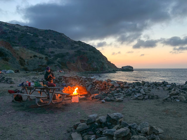
Santa Catalina is one of several islands located a relatively short distance off the coast of Southern California.


It's permanently inhabited by around 4,000 people most of whom are centered around the main settlement / tourist attraction known as Avalon.  Most of the rest of the island is controlled by the Catalina Island Conservancy and has a more rustic feel to it despite the existence of dirt roads and cell service almost everywhere.  They do control vehicle access but you can pay to get almost anything including yourself delivered to one of only 5 campgrounds.

The island is also famous for the buffalo herds that were originally transported to the island for a movie only to be abandoned and have lived there ever since.  And there's also a unique species of fox that is only found on the island.

There is a trail that runs from one side to the other called the Trans-Catalina Trail that's been on my radar for years.  Since I'd only ever been to Avalon it seemed like an ideal way to see more of the island.  I never got around to it before now mostly due to the cost and extra hassles involved vs my usual Sierra or desert based weekend adventures.  You have to reserve campsites, pay for a boat ride, and I'd heard from others that it was mostly a steep hike on fire roads.

Then this year I let Jen Blackie convince me to finally take a precious four day weekend in between WTC and AMP and head out there.  And it turned out to be one of my favorite trips of the past few years despite the odd mix of civilization (cellphone coverage, vehicle access to the entire island) intruding into the wilderness-y experience I'm generally looking for.

Kaweah WTC Snow Camp 2018 Goes Negative!

March 16th to 18th, 2018
[Pics] [Map]

Each year the 10 week Sierra Club Wilderness Travel Course builds up to a three day two night winter backpack outing into the Sierra Nevada.  And each year the staff nervously watch the snow forecast hoping we don't have a repeat of 2015 where we barely had enough snow to set up tents on.

This year it looked grim until right before the snow travel outing at which point a series of storms starting hitting both the local mountains and the Sierra.  By the week before snow camp we knew we were in for something memorable.


Even if the weather fizzled (which it didn't) this was looking to be the coldest snow camp in years!

Sheep and Martinez Backpack Santa Rosa Wilderness

February 23rd to 25th, 2018
Sheep Mountain (5,141')
Martinez Mountain (6,562')
Day 1: 2.4 miles, 300'
Day 2: 10.5 miles, 2,500'
Day 3: 9.7 miles, 2,500'
[Pics] [CalTopo] [Map]

Wilderness Travel Course season gets pretty busy with most weekends being tied up in class outings but we do have the occasional opportunity to get out.  This trip was snuck in between the Orange County Joshua Tree and Snow Travel weekends.  In addition to just being a good excuse to get out and backpack in the local mountains was as an I Provisional for Jen Jones and had the added benefit of being a variation of something I'd done before that I'd wanted to scout as a potential WTC Experience Trip.

Unlike most trips where we drive out the night before and hike in in the morning our plan was to do the initial 2.5 miles Friday night to a known water source and then fill up in the morning and do another 2.5 miles to a dry camp near Cactus Spring.  We'd then dayhike Martinez, return to camp, and then Sunday do Sheep before hiking out.

And as an added bonus we had a winter storm sweep in dropping the temperatures to a low of 27.  Fun!

Wilderness Travel Course Joshua Tree Weekend With Kaweah Group

February 17th & 18th, 2018
[Pics] [CalTopo]

Joshua Tree is the second of four outings that make up the Sierra Club Wilderness Travel Course.  Two weeks ago everyone joined us for a 15 mile -ish dayhike and now we had an entire weekend bus trip out to Indian Cove to focus on rock scrambling skills and navigation!

And since we're Kaweah Group (one of the three groups in the Orange County area of WTC) we like to throw a theme into the mix for our summit shot and potluck.  Themes are suggested and voted on by the class and previous years have run the gamut from simple to elaborate.  This year the winner was Medical Misadventure beating out Business Casual Murder Clowns by a very small margin.  The result is what you see above!

For more information on what WTC is and how to take the course see the official site here. More posts by me about WTC can be found here.

Whale Watching At Laguna Ojo de Liebre In Baja

February 10th to 12th, 2018
[Map]

This trip was a little different than my normal weekend fare since it didn't involve any peaks, hikes, or hot springs.  Victor Gomez and Lubna Debbini are two friends who came through WTC last year and they put this trip together around whale watching down at Laguna Ojo de Libre.

If you're like me and only ever seen whales Newport Beach style in the distance from the deck of a large boat the experience at Laguna Ojo de Liebre will completely ruin that for you.  Whales migrate here from Alaska to give birth and teach their babies how to swim.  These days it's carefully controlled so that only a set number of boats can go out and only in certain areas for 90 minutes at a time.  It's somewhat famous due to the fact the whales come so close to the boats that if you're lucky you can reach out and touch them.

Santiago Peak Wilderness Travel Course Kaweah Group Conditioning Hike

February 3rd, 2018
Santiago Peak (5,687')
[Pics] [CalTopo] [Map]

It's that time of year again where we start taking the new crop of Wilderness Travel Course students on outings!  After three weeks of classroom sessions we spent Saturday hiking Santiago Peak via the Holy Jim Trail.   It's an Orange County classic it involving 15 ish miles and 4k gain all on trail making it a great fitness assessment before we continue on to the rock scrambling, snowshoe, and finally a winter backpack in the Sierra!